Area Overview for E18 1PG
Photos of E18 1PG
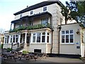
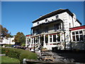
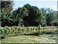
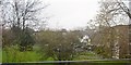
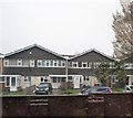
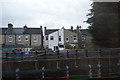
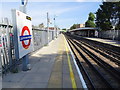
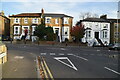

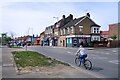
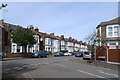
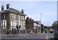
37 photos from this area
Area Information
Key information about the E18 1PG including its size, population, and administrative classification.
- Area Type
- Postcode
- Area Size
- 6061 m²
- Population
- 1586
- Population Density
- 7005 people/km²
House Prices in E18 1PG
17
Properties
£387,545
Average Sold Price
£108,000
Lowest Price
£860,000
Highest Price
Showing 17 properties
| Address | Type | Beds | Baths | Last Sale Price | Last Sale Date | |
|---|---|---|---|---|---|---|
| 34 Charnwood Drive, South Woodford, London, E18 1PG | Semi-detached | 4 | 2 | £860,000 | Nov 2019 | |
| 38 Charnwood Drive, South Woodford, London, E18 1PG | house | - | - | £670,000 | Aug 2019 | |
| 54 Charnwood Drive, South Woodford, London, E18 1PG | house | - | - | £420,000 | Dec 2012 | |
| 46 Charnwood Drive, South Woodford, London, E18 1PG | Terraced | - | - | £125,000 | Aug 2012 | |
| 40 Charnwood Drive, South Woodford, London, E18 1PG | house | 3 | - | £395,000 | May 2012 | |
| 52 Charnwood Drive, South Woodford, London, E18 1PG | house | - | - | £410,000 | Mar 2011 | |
| 36 Charnwood Drive, South Woodford, London, E18 1PG | Terraced | - | - | £401,000 | Feb 2008 | |
| 48 Charnwood Drive, South Woodford, London, E18 1PG | Terraced | 3 | 1 | £390,000 | Jan 2008 | |
| 42 Charnwood Drive, South Woodford, London, E18 1PG | Terraced | - | - | £249,000 | Dec 2003 | |
| 50 Charnwood Drive, South Woodford, London, E18 1PG | Semi-detached | - | - | £235,000 | Nov 2002 |
Page 1 of 2
Energy Efficiency in E18 1PG
Amenities
Schools
| Rank | School | Type | Entry gender | Ages |
|---|
Explore more schools in this area
Go to Schools tabDemographics
Household Size
Family (3-5 people)
most common
Accommodation Type
Houses
most common
Tenure
87
majority
Ethnic Group
White
most common
Religion
N/A
most common
Household Composition
N/A
most common
Age
47
median
Adults (30-64 years)
most common
Household Deprivation
N/A
with no deprivation
NS-SEC
52
in Lower managerial occupations
Explore more demographic insights in this area
Go to Demographics tabPlanning
Planning Constraints
- Flood RiskPremium
- Ramsar Wetland SitesPremium
- Area of Outstanding Natural BeautyPremium
- Protected Nature ReservePremium
- Protected WoodlandPremium