Area Overview for E18 1BW
Photos of E18 1BW


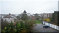
47 photos from this area
Area Information
Key information about the E18 1BW including its size, population, and administrative classification.
- Area Type
- Postcode
- Area Size
- 6844 m²
- Population
- 2424
- Population Density
- 9062 people/km²
House Prices in E18 1BW
21
Properties
£473,124
Average Sold Price
£60,000
Lowest Price
£1,265,000
Highest Price
Showing 21 properties
| Address | Type | Beds | Baths | Last Sale Price | Last Sale Date | |
|---|---|---|---|---|---|---|
| 12 Eastwood Road, South Woodford, London, E18 1BW | house | - | - | £1,265,000 | Sep 2022 | |
| 36 Eastwood Road, South Woodford, London, E18 1BW | house | - | - | £930,000 | Jul 2021 | |
| 26 Eastwood Road, South Woodford, London, E18 1BW | house | - | - | £465,000 | Feb 2009 | |
| 14 Eastwood Road, South Woodford, London, E18 1BW | house | 4 | 1 | £440,000 | Dec 2008 | |
| 22 Eastwood Road, South Woodford, London, E18 1BW | Semi-detached | - | - | £249,995 | Jan 2008 | |
| 18 Eastwood Road, South Woodford, London, E18 1BW | house | - | - | £225,000 | Sep 1998 | |
| 10A Eastwood Road, South Woodford, London, E18 1BW | Flat | - | - | £60,000 | May 1998 | |
| 2 Eastwood Road, South Woodford, London, E18 1BW | house | - | - | £150,000 | Aug 1997 | |
| 16 Eastwood Road, South Woodford, London, E18 1BW | Semi-detached | - | - | - | - | |
| 28 Eastwood Road, South Woodford, London, E18 1BW | Semi-detached | - | - | - | - |
Page 1 of 3
Energy Efficiency in E18 1BW
Amenities
Schools
| Rank | School | Type | Entry gender | Ages |
|---|
Explore more schools in this area
Go to Schools tabDemographics
Household Size
One person
most common
Accommodation Type
Flats
most common
Tenure
41
majority
Ethnic Group
White
most common
Religion
N/A
most common
Household Composition
N/A
most common
Age
47
median
Adults (30-64 years)
most common
Household Deprivation
N/A
with no deprivation
NS-SEC
50
in Lower managerial occupations
Explore more demographic insights in this area
Go to Demographics tabPlanning
Planning Constraints
- Flood RiskPremium
- Ramsar Wetland SitesPremium
- Area of Outstanding Natural BeautyPremium
- Protected Nature ReservePremium
- Protected WoodlandPremium