Area Overview for E17 9ET
Photos of E17 9ET
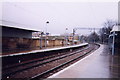
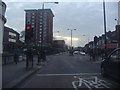
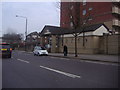
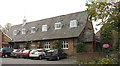
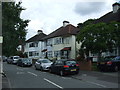
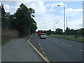
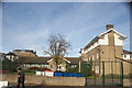
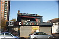
98 photos from this area
Area Information
Key information about the E17 9ET including its size, population, and administrative classification.
- Area Type
- Postcode
- Area Size
- 6540 m²
- Population
- 1607
- Population Density
- 13974 people/km²
House Prices in E17 9ET
40
Properties
£421,416
Average Sold Price
£82,000
Lowest Price
£932,500
Highest Price
Showing 40 properties
| Address | Type | Beds | Baths | Last Sale Price | Last Sale Date | |
|---|---|---|---|---|---|---|
| 62 Barrett Road, Walthamstow, E17 9ET | Terraced | 3 | 1 | £740,000 | Apr 2025 | |
| 4 Barrett Road, Walthamstow, E17 9ET | Terraced | 4 | 1 | £910,000 | Dec 2024 | |
| 46 Barrett Road, Walthamstow, E17 9ET | house | - | - | £855,000 | Dec 2024 | |
| 32 Barrett Road, Walthamstow, E17 9ET | Terraced | 5 | 2 | £932,500 | Jul 2023 | |
| 64 Barrett Road, Walthamstow, E17 9ET | Flat | 2 | 1 | £525,000 | Jan 2023 | |
| 44 Barrett Road, Walthamstow, E17 9ET | house | - | - | £807,000 | Mar 2021 | |
| 22A Barrett Road, Walthamstow, E17 9ET | Terraced | 3 | 1 | £446,000 | Sep 2019 | |
| 50A Barrett Road, Walthamstow, E17 9ET | Flat | - | - | £475,250 | Dec 2016 | |
| 6 Barrett Road, Walthamstow, E17 9ET | Terraced | 5 | 2 | £650,000 | Aug 2015 | |
| 2 Barrett Road, Walthamstow, E17 9ET | Terraced | 3 | 1 | £450,000 | May 2013 |
Page 1 of 4
Energy Efficiency in E17 9ET
Amenities
Schools
| Rank | School | Type | Entry gender | Ages |
|---|
Explore more schools in this area
Go to Schools tabDemographics
Household Size
Family (3-5 people)
most common
Accommodation Type
Houses
most common
Tenure
67
majority
Ethnic Group
White
most common
Religion
N/A
most common
Household Composition
N/A
most common
Age
47
median
Adults (30-64 years)
most common
Household Deprivation
N/A
with no deprivation
NS-SEC
45
in Lower managerial occupations
Explore more demographic insights in this area
Go to Demographics tabPlanning
Planning Constraints
- Flood RiskPremium
- Ramsar Wetland SitesPremium
- Area of Outstanding Natural BeautyPremium
- Protected Nature ReservePremium
- Protected WoodlandPremium