Area Overview for E17 8BY
Photos of E17 8BY
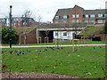
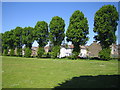
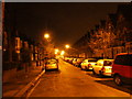
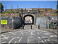
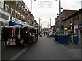
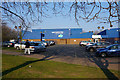
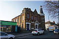
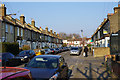


100 photos from this area
Area Information
Key information about the E17 8BY including its size, population, and administrative classification.
- Area Type
- Postcode
- Area Size
- 4192 m²
- Population
- Not available
- Population Density
- Not available
House Prices in E17 8BY
32
Properties
£405,346
Average Sold Price
£69,000
Lowest Price
£803,000
Highest Price
Showing 32 properties
| Address | Type | Beds | Baths | Last Sale Price | Last Sale Date | |
|---|---|---|---|---|---|---|
| 29 Downsfield Road, Walthamstow, E17 8BY | house | - | - | £460,000 | Jun 2025 | |
| 27 Downsfield Road, Walthamstow, E17 8BY | Terraced | 3 | 1 | £803,000 | Jun 2024 | |
| 39 Downsfield Road, Walthamstow, E17 8BY | Terraced | 3 | 1 | £711,000 | May 2021 | |
| 49 Downsfield Road, Walthamstow, E17 8BY | Terraced | 2 | - | £626,000 | Apr 2021 | |
| 37 Downsfield Road, Walthamstow, E17 8BY | Terraced | 3 | 2 | £708,000 | Mar 2021 | |
| 23 Downsfield Road, Walthamstow, E17 8BY | house | - | - | £565,125 | Jan 2021 | |
| 35 Downsfield Road, Walthamstow, E17 8BY | Terraced | 5 | 2 | £463,100 | Aug 2019 | |
| 55 Downsfield Road, Walthamstow, E17 8BY | Terraced | 4 | - | £650,000 | Jul 2019 | |
| 25 Downsfield Road, Walthamstow, E17 8BY | Terraced | 3 | 2 | £450,000 | Apr 2018 | |
| 57 Downsfield Road, Walthamstow, E17 8BY | Terraced | - | - | £235,000 | Jul 2017 |
Page 1 of 4
Energy Efficiency in E17 8BY
Amenities
Schools
| Rank | School | Type | Entry gender | Ages |
|---|
Explore more schools in this area
Go to Schools tabDemographics
Household Size
Family (3-5 people)
most common
Accommodation Type
Houses
most common
Tenure
51
majority
Ethnic Group
White
most common
Religion
N/A
most common
Household Composition
N/A
most common
Age
47
median
Adults (30-64 years)
most common
Household Deprivation
N/A
with no deprivation
NS-SEC
37
in Lower managerial occupations
Explore more demographic insights in this area
Go to Demographics tabPlanning
Planning Constraints
- Flood RiskPremium
- Ramsar Wetland SitesPremium
- Area of Outstanding Natural BeautyPremium
- Protected Nature ReservePremium
- Protected WoodlandPremium