Area Overview for E17 8AP
Photos of E17 8AP
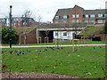
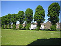
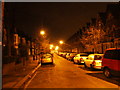
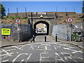
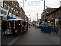

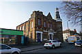
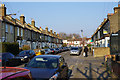


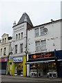
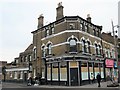
100 photos from this area
Area Information
Key information about the E17 8AP including its size, population, and administrative classification.
- Area Type
- Postcode
- Area Size
- 8701 m²
- Population
- Not available
- Population Density
- Not available
House Prices in E17 8AP
70
Properties
£424,575
Average Sold Price
£49,500
Lowest Price
£960,000
Highest Price
Showing 70 properties
| Address | Type | Beds | Baths | Last Sale Price | Last Sale Date | |
|---|---|---|---|---|---|---|
| 11 Clacton Road, Walthamstow, E17 8AP | house | - | - | £660,000 | Oct 2025 | |
| 81 Clacton Road, Walthamstow, E17 8AP | Terraced | 2 | 1 | £717,500 | Sep 2025 | |
| 17 Clacton Road, Walthamstow, E17 8AP | Terraced | 2 | 2 | £960,000 | Mar 2025 | |
| 45 Clacton Road, Walthamstow, E17 8AP | Terraced | 2 | 1 | £720,000 | Mar 2025 | |
| 71 Clacton Road, Walthamstow, E17 8AP | Detached | 3 | 1 | £714,500 | Nov 2024 | |
| 93 Clacton Road, Walthamstow, E17 8AP | Terraced | 4 | 2 | £670,000 | May 2024 | |
| 53B Clacton Road, Walthamstow, E17 8AP | Flat | 2 | 2 | £450,000 | Apr 2024 | |
| 137 Clacton Road, Walthamstow, E17 8AP | Maisonette | - | - | £482,500 | Aug 2023 | |
| 25 Clacton Road, Walthamstow, E17 8AP | Terraced | 2 | - | £539,000 | Jul 2023 | |
| 43 Clacton Road, Walthamstow, E17 8AP | Terraced | 3 | 1 | £738,000 | Apr 2023 |
Page 1 of 7
Energy Efficiency in E17 8AP
Amenities
Schools
| Rank | School | Type | Entry gender | Ages |
|---|
Explore more schools in this area
Go to Schools tabDemographics
Household Size
Family (3-5 people)
most common
Accommodation Type
Houses
most common
Tenure
51
majority
Ethnic Group
White
most common
Religion
N/A
most common
Household Composition
N/A
most common
Age
47
median
Adults (30-64 years)
most common
Household Deprivation
N/A
with no deprivation
NS-SEC
36
in Lower managerial occupations
Explore more demographic insights in this area
Go to Demographics tabPlanning
Planning Constraints
- Flood RiskPremium
- Ramsar Wetland SitesPremium
- Area of Outstanding Natural BeautyPremium
- Protected Nature ReservePremium
- Protected WoodlandPremium