Area Overview for E17 7QB
Photos of E17 7QB
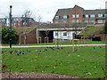
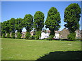
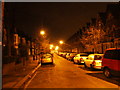
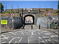
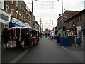

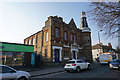
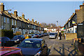
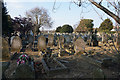
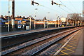
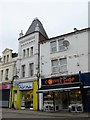
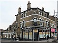
100 photos from this area
Area Information
Key information about the E17 7QB including its size, population, and administrative classification.
- Area Type
- Postcode
- Area Size
- 2.5 hectares
- Population
- 2088
- Population Density
- 12269 people/km²
House Prices in E17 7QB
69
Properties
£312,604
Average Sold Price
£52,000
Lowest Price
£760,000
Highest Price
Showing 69 properties
| Address | Type | Beds | Baths | Last Sale Price | Last Sale Date | |
|---|---|---|---|---|---|---|
| 88 Edinburgh Road, Walthamstow, E17 7QB | Terraced | 4 | 2 | £580,000 | Feb 2025 | |
| 16 Edinburgh Road, Walthamstow, E17 7QB | Flat | - | - | £249,995 | Jan 2022 | |
| 64 Edinburgh Road, Walthamstow, E17 7QB | Terraced | 2 | - | £760,000 | Feb 2021 | |
| 92 Edinburgh Road, Walthamstow, E17 7QB | Terraced | 3 | 1 | £655,000 | May 2020 | |
| 62 Edinburgh Road, Walthamstow, E17 7QB | Terraced | 4 | 2 | £715,000 | Sep 2019 | |
| 40 Edinburgh Road, Walthamstow, E17 7QB | Terraced | 4 | 2 | £560,000 | Nov 2018 | |
| 102 Edinburgh Road, Walthamstow, E17 7QB | Terraced | 3 | - | £572,000 | Dec 2017 | |
| 36 Edinburgh Road, Walthamstow, E17 7QB | Flat | 1 | 1 | £265,000 | Dec 2014 | |
| 68 Edinburgh Road, Walthamstow, E17 7QB | house | - | - | £336,000 | Jan 2014 | |
| 42 Edinburgh Road, Walthamstow, E17 7QB | Terraced | 3 | 1 | £340,000 | Oct 2013 |
Page 1 of 7
Energy Efficiency in E17 7QB
Amenities
Schools
| Rank | School | Type | Entry gender | Ages |
|---|
Explore more schools in this area
Go to Schools tabDemographics
Household Size
Family (3-5 people)
most common
Accommodation Type
Houses
most common
Tenure
53
majority
Ethnic Group
White
most common
Religion
N/A
most common
Household Composition
N/A
most common
Age
47
median
Adults (30-64 years)
most common
Household Deprivation
N/A
with no deprivation
NS-SEC
34
in Lower managerial occupations
Explore more demographic insights in this area
Go to Demographics tabPlanning
Planning Constraints
- Flood RiskPremium
- Ramsar Wetland SitesPremium
- Area of Outstanding Natural BeautyPremium
- Protected Nature ReservePremium
- Protected WoodlandPremium