Area Overview for E17 7DA
Photos of E17 7DA
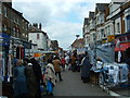

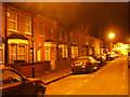
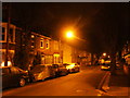
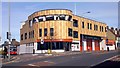
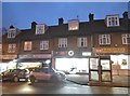
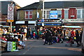
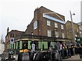
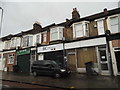

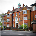
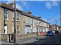
100 photos from this area
Area Information
Key information about the E17 7DA including its size, population, and administrative classification.
- Area Type
- Postcode
- Area Size
- 5543 m²
- Population
- Not available
- Population Density
- Not available
House Prices in E17 7DA
23
Properties
£305,661
Average Sold Price
£58,000
Lowest Price
£704,000
Highest Price
Showing 23 properties
| Address | Type | Beds | Baths | Last Sale Price | Last Sale Date | |
|---|---|---|---|---|---|---|
| 31 Storey Road, Walthamstow, E17 7DA | Semi-detached | 2 | 1 | £576,000 | Oct 2020 | |
| 33 Storey Road, Walthamstow, E17 7DA | Semi-detached | 2 | 2 | £490,000 | Oct 2019 | |
| 7 Storey Road, Walthamstow, E17 7DA | Terraced | 4 | 2 | £704,000 | Mar 2016 | |
| 29 Storey Road, Walthamstow, E17 7DA | house | 3 | 2 | £311,000 | Oct 2012 | |
| 23 Storey Road, Walthamstow, E17 7DA | house | - | - | £238,000 | Nov 2011 | |
| 11 Storey Road, Walthamstow, E17 7DA | house | - | - | £229,000 | Dec 2005 | |
| 2 Storey Road, Walthamstow, E17 7DA | Terraced | 4 | - | £58,000 | May 2002 | |
| 9 Storey Road, Walthamstow, E17 7DA | Terraced | - | - | £85,000 | Feb 1998 | |
| 4 Storey Road, Walthamstow, E17 7DA | house | - | - | £59,950 | Dec 1996 | |
| Ground Floor Flat, 5 Storey Road, Walthamstow, E17 7DA | Flat | 2 | 1 | - | - |
Page 1 of 3
Energy Efficiency in E17 7DA
Amenities
Schools
| Rank | School | Type | Entry gender | Ages |
|---|
Explore more schools in this area
Go to Schools tabDemographics
Household Size
Two person
most common
Accommodation Type
Flats
most common
Tenure
44
majority
Ethnic Group
White
most common
Religion
N/A
most common
Household Composition
N/A
most common
Age
47
median
Adults (30-64 years)
most common
Household Deprivation
N/A
with no deprivation
NS-SEC
39
in Lower managerial occupations
Explore more demographic insights in this area
Go to Demographics tabPlanning
Planning Constraints
- Flood RiskPremium
- Ramsar Wetland SitesPremium
- Area of Outstanding Natural BeautyPremium
- Protected Nature ReservePremium
- Protected WoodlandPremium