Area Overview for E17 6RS
Photos of E17 6RS
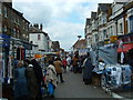
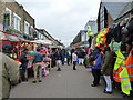
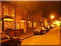
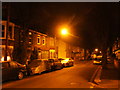
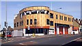
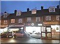
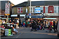
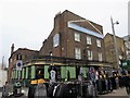
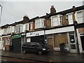

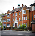
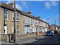
100 photos from this area
Area Information
Key information about the E17 6RS including its size, population, and administrative classification.
- Area Type
- Postcode
- Area Size
- 7752 m²
- Population
- Not available
- Population Density
- Not available
House Prices in E17 6RS
49
Properties
£467,973
Average Sold Price
£25,600
Lowest Price
£1,000,000
Highest Price
Showing 49 properties
| Address | Type | Beds | Baths | Last Sale Price | Last Sale Date | |
|---|---|---|---|---|---|---|
| 72 Somers Road, Walthamstow, E17 6RS | Terraced | 4 | 2 | £950,000 | Sep 2024 | |
| 85B Somers Road, Walthamstow, E17 6RS | Flat | 3 | 2 | £395,000 | Feb 2024 | |
| 78A Somers Road, Walthamstow, E17 6RS | Flat | - | - | £490,000 | Apr 2022 | |
| 84 Somers Road, Walthamstow, E17 6RS | house | - | - | £625,000 | Apr 2021 | |
| 70 Somers Road, Walthamstow, E17 6RS | Terraced | 5 | 3 | £1,000,000 | Feb 2017 | |
| 97 Somers Road, Walthamstow, E17 6RS | Terraced | 3 | - | £530,000 | Oct 2015 | |
| 87 Somers Road, Walthamstow, E17 6RS | Terraced | 5 | 2 | £850,000 | Oct 2015 | |
| 92 Somers Road, Walthamstow, E17 6RS | Terraced | 3 | 2 | £600,000 | Jan 2015 | |
| 101 Somers Road, Walthamstow, E17 6RS | Terraced | 5 | 1 | £315,000 | Aug 2011 | |
| 73 Somers Road, Walthamstow, E17 6RS | house | - | - | £266,000 | Sep 2009 |
Page 1 of 5
Energy Efficiency in E17 6RS
Amenities
Schools
| Rank | School | Type | Entry gender | Ages |
|---|
Explore more schools in this area
Go to Schools tabDemographics
Household Size
Two person
most common
Accommodation Type
Flats
most common
Tenure
44
majority
Ethnic Group
White
most common
Religion
N/A
most common
Household Composition
N/A
most common
Age
47
median
Adults (30-64 years)
most common
Household Deprivation
N/A
with no deprivation
NS-SEC
39
in Lower managerial occupations
Explore more demographic insights in this area
Go to Demographics tabPlanning
Planning Constraints
- Flood RiskPremium
- Ramsar Wetland SitesPremium
- Area of Outstanding Natural BeautyPremium
- Protected Nature ReservePremium
- Protected WoodlandPremium