Area Overview for E17 5RY
Photos of E17 5RY
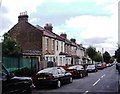
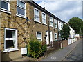
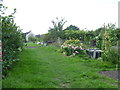
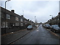
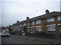
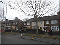
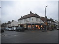
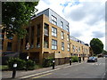
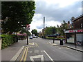
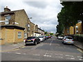
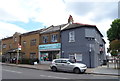
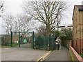
37 photos from this area
Area Information
Key information about the E17 5RY including its size, population, and administrative classification.
- Area Type
- Postcode
- Area Size
- 1.1 hectares
- Population
- 1898
- Population Density
- 10990 people/km²
House Prices in E17 5RY
65
Properties
£256,198
Average Sold Price
£48,000
Lowest Price
£710,000
Highest Price
Showing 65 properties
| Address | Type | Beds | Baths | Last Sale Price | Last Sale Date | |
|---|---|---|---|---|---|---|
| 115A Manor Road, Walthamstow, E17 5RY | Flat | 1 | 1 | £253,000 | Mar 2025 | |
| 37 Manor Road, Walthamstow, E17 5RY | Flat | 2 | 1 | £370,224 | Apr 2024 | |
| 25 Manor Road, Walthamstow, E17 5RY | Flat | - | - | £380,000 | Nov 2023 | |
| 87 Manor Road, Walthamstow, E17 5RY | Flat | 2 | 1 | £460,000 | Jan 2023 | |
| 105 Manor Road, Walthamstow, E17 5RY | Retail | 4 | 2 | £710,000 | Oct 2022 | |
| 33 Manor Road, Walthamstow, E17 5RY | Flat | 3 | 1 | £450,000 | Aug 2022 | |
| 5 Manor Road, Walthamstow, E17 5RY | house | - | - | £480,000 | May 2022 | |
| 77 Manor Road, Walthamstow, E17 5RY | Terraced | 2 | 1 | £420,000 | May 2021 | |
| 115 Manor Road, Walthamstow, E17 5RY | Flat | - | - | £291,000 | Dec 2020 | |
| 27 Manor Road, Walthamstow, E17 5RY | Flat | - | - | £310,000 | Jul 2018 |
Page 1 of 7
Energy Efficiency in E17 5RY
Amenities
Schools
| Rank | School | Type | Entry gender | Ages |
|---|
Explore more schools in this area
Go to Schools tabDemographics
Household Size
Family (3-5 people)
most common
Accommodation Type
Houses
most common
Tenure
51
majority
Ethnic Group
White
most common
Religion
N/A
most common
Household Composition
N/A
most common
Age
47
median
Adults (30-64 years)
most common
Household Deprivation
N/A
with no deprivation
NS-SEC
32
in Lower managerial occupations
Explore more demographic insights in this area
Go to Demographics tabPlanning
Planning Constraints
- Flood RiskPremium
- Ramsar Wetland SitesPremium
- Area of Outstanding Natural BeautyPremium
- Protected Nature ReservePremium
- Protected WoodlandPremium