Area Overview for E17 5RA
Photos of E17 5RA
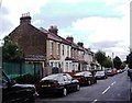
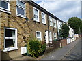
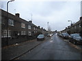
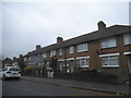
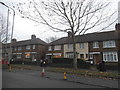
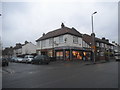
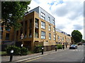
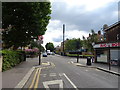
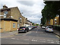
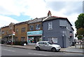
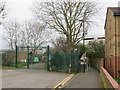
37 photos from this area
Area Information
Key information about the E17 5RA including its size, population, and administrative classification.
- Area Type
- Postcode
- Area Size
- 1.4 hectares
- Population
- 1898
- Population Density
- 10990 people/km²
House Prices in E17 5RA
65
Properties
£338,688
Average Sold Price
£70,000
Lowest Price
£630,000
Highest Price
Showing 65 properties
| Address | Type | Beds | Baths | Last Sale Price | Last Sale Date | |
|---|---|---|---|---|---|---|
| 87 Carlton Road, Walthamstow, E17 5RA | Terraced | 2 | 1 | £565,000 | Dec 2024 | |
| 95 Carlton Road, Walthamstow, E17 5RA | Terraced | 3 | 1 | £504,000 | Aug 2024 | |
| 1 Carlton Road, Walthamstow, E17 5RA | Terraced | 4 | 3 | £600,000 | Apr 2023 | |
| 59 Carlton Road, Walthamstow, E17 5RA | Maisonette | 2 | 1 | £365,000 | Jun 2022 | |
| 105 Carlton Road, Walthamstow, E17 5RA | Retail | 2 | 1 | £525,000 | May 2022 | |
| 23 Carlton Road, Walthamstow, E17 5RA | house | - | - | £630,000 | Aug 2021 | |
| 71 Carlton Road, Walthamstow, E17 5RA | house | - | - | £503,750 | Jul 2021 | |
| 93 Carlton Road, Walthamstow, E17 5RA | house | - | - | £500,000 | Jun 2021 | |
| 107 Carlton Road, Walthamstow, E17 5RA | Terraced | 3 | 2 | £590,000 | Jul 2020 | |
| 99 Carlton Road, Walthamstow, E17 5RA | Terraced | 2 | 1 | £473,500 | Feb 2020 |
Page 1 of 7
Energy Efficiency in E17 5RA
Amenities
Schools
| Rank | School | Type | Entry gender | Ages |
|---|
Explore more schools in this area
Go to Schools tabDemographics
Household Size
Family (3-5 people)
most common
Accommodation Type
Houses
most common
Tenure
51
majority
Ethnic Group
White
most common
Religion
N/A
most common
Household Composition
N/A
most common
Age
47
median
Adults (30-64 years)
most common
Household Deprivation
N/A
with no deprivation
NS-SEC
32
in Lower managerial occupations
Explore more demographic insights in this area
Go to Demographics tabPlanning
Planning Constraints
- Flood RiskPremium
- Ramsar Wetland SitesPremium
- Area of Outstanding Natural BeautyPremium
- Protected Nature ReservePremium
- Protected WoodlandPremium