Area Overview for E17 5EG
Photos of E17 5EG
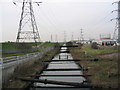
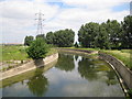
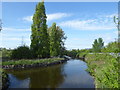
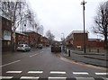
15 photos from this area
Area Information
Key information about the E17 5EG including its size, population, and administrative classification.
- Area Type
- Postcode
- Area Size
- 1.4 hectares
- Population
- 1890
- Population Density
- 2386 people/km²
House Prices in E17 5EG
67
Properties
£258,535
Average Sold Price
£53,000
Lowest Price
£630,000
Highest Price
Showing 67 properties
| Address | Type | Beds | Baths | Last Sale Price | Last Sale Date | |
|---|---|---|---|---|---|---|
| 43 Stow Crescent, Walthamstow, E17 5EG | Terraced | 4 | 1 | £630,000 | Aug 2025 | |
| 20 Stow Crescent, Walthamstow, E17 5EG | house | - | - | £240,000 | Oct 2021 | |
| 18 Stow Crescent, Walthamstow, E17 5EG | house | - | - | £485,000 | Jun 2021 | |
| 3 Stow Crescent, Walthamstow, E17 5EG | Terraced | 4 | 2 | £415,000 | Jun 2021 | |
| 16 Stow Crescent, Walthamstow, E17 5EG | house | - | - | £410,000 | Jun 2021 | |
| 7 Stow Crescent, Walthamstow, E17 5EG | house | 3 | 2 | £418,000 | Sep 2019 | |
| 47 Stow Crescent, Walthamstow, E17 5EG | Terraced | 3 | 1 | £410,000 | Sep 2017 | |
| 59 Stow Crescent, Walthamstow, E17 5EG | Terraced | 3 | 1 | £415,000 | Mar 2016 | |
| 19 Stow Crescent, Walthamstow, E17 5EG | Semi-detached | 3 | 1 | £360,000 | Dec 2015 | |
| 28 Stow Crescent, Walthamstow, E17 5EG | Terraced | 3 | 1 | £360,000 | Mar 2015 |
Page 1 of 7
Energy Efficiency in E17 5EG
Amenities
Schools
| Rank | School | Type | Entry gender | Ages |
|---|
Explore more schools in this area
Go to Schools tabDemographics
Household Size
Family (3-5 people)
most common
Accommodation Type
Houses
most common
Tenure
32
majority
Ethnic Group
White
most common
Religion
N/A
most common
Household Composition
N/A
most common
Age
47
median
Adults (30-64 years)
most common
Household Deprivation
N/A
with no deprivation
NS-SEC
21
in Lower managerial occupations
Explore more demographic insights in this area
Go to Demographics tabPlanning
Planning Constraints
- Flood RiskPremium
- Ramsar Wetland SitesPremium
- Area of Outstanding Natural BeautyPremium
- Protected Nature ReservePremium
- Protected WoodlandPremium