Area Overview for E17 5AF
Photos of E17 5AF


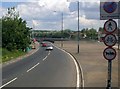
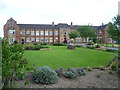
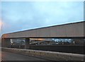
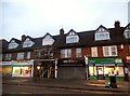
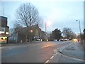


61 photos from this area
Area Information
Key information about the E17 5AF including its size, population, and administrative classification.
- Area Type
- Postcode
- Area Size
- 3556 m²
- Population
- 1904
- Population Density
- 4979 people/km²
House Prices in E17 5AF
29
Properties
£253,745
Average Sold Price
£76,000
Lowest Price
£460,000
Highest Price
Showing 29 properties
| Address | Type | Beds | Baths | Last Sale Price | Last Sale Date | |
|---|---|---|---|---|---|---|
| 383 Chingford Road, Walthamstow, E17 5AF | Flat | 2 | 1 | £460,000 | Sep 2024 | |
| 425 Chingford Road, Walthamstow, E17 5AF | Flat | 2 | 1 | £450,000 | Dec 2023 | |
| 381 Chingford Road, Walthamstow, E17 5AF | Maisonette | 2 | 1 | £358,920 | Sep 2023 | |
| 391 Chingford Road, Walthamstow, E17 5AF | Flat | 2 | 1 | £388,500 | Sep 2022 | |
| 401 Chingford Road, Walthamstow, E17 5AF | Maisonette | 2 | 1 | £420,000 | Jan 2022 | |
| 411A Chingford Road, Walthamstow, E17 5AF | Flat | 2 | - | £235,000 | Apr 2019 | |
| 373 Chingford Road, Walthamstow, E17 5AF | Flat | 2 | 1 | £370,000 | Jan 2018 | |
| 379 Chingford Road, Walthamstow, E17 5AF | Flat | - | - | £276,000 | Aug 2014 | |
| 415 Chingford Road, Walthamstow, E17 5AF | Maisonette | - | - | £140,000 | Nov 2010 | |
| 413A Chingford Road, Walthamstow, E17 5AF | Flat | - | - | £175,000 | Nov 2008 |
Page 1 of 3
Energy Efficiency in E17 5AF
Amenities
Schools
| Rank | School | Type | Entry gender | Ages |
|---|
Explore more schools in this area
Go to Schools tabDemographics
Household Size
Family (3-5 people)
most common
Accommodation Type
Houses
most common
Tenure
49
majority
Ethnic Group
White
most common
Religion
N/A
most common
Household Composition
N/A
most common
Age
47
median
Adults (30-64 years)
most common
Household Deprivation
N/A
with no deprivation
NS-SEC
28
in Lower managerial occupations
Explore more demographic insights in this area
Go to Demographics tabPlanning
Planning Constraints
- Flood RiskPremium
- Ramsar Wetland SitesPremium
- Area of Outstanding Natural BeautyPremium
- Protected Nature ReservePremium
- Protected WoodlandPremium