Area Overview for E17 4SJ
Photos of E17 4SJ
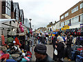
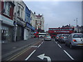
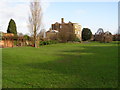
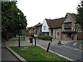
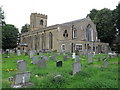
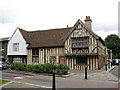

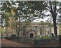
100 photos from this area
Area Information
Key information about the E17 4SJ including its size, population, and administrative classification.
- Area Type
- Postcode
- Area Size
- 8954 m²
- Population
- Not available
- Population Density
- Not available
House Prices in E17 4SJ
48
Properties
£555,568
Average Sold Price
£79,000
Lowest Price
£1,415,926
Highest Price
Showing 48 properties
| Address | Type | Beds | Baths | Last Sale Price | Last Sale Date | |
|---|---|---|---|---|---|---|
| 68 Howard Road, Walthamstow, E17 4SJ | house | 6 | 2 | £1,200,000 | Feb 2024 | |
| 62 Howard Road, Walthamstow, E17 4SJ | Terraced | 5 | 3 | £1,415,926 | Aug 2023 | |
| 60 Howard Road, Walthamstow, E17 4SJ | house | 3 | 1 | £1,250,000 | Jul 2022 | |
| 20 Howard Road, Walthamstow, E17 4SJ | house | - | - | £677,500 | Feb 2021 | |
| 64 Howard Road, Walthamstow, E17 4SJ | Terraced | 4 | 2 | £1,145,000 | Dec 2020 | |
| 40 Howard Road, Walthamstow, E17 4SJ | house | 4 | 2 | £1,140,000 | Dec 2020 | |
| 36A Howard Road, Walthamstow, E17 4SJ | Flat | 2 | 1 | £490,000 | Nov 2020 | |
| 2 Howard Road, Walthamstow, E17 4SJ | Terraced | 3 | 1 | £713,000 | Jun 2019 | |
| 52 Howard Road, Walthamstow, E17 4SJ | Flat | - | - | £492,500 | Sep 2016 | |
| 54 Howard Road, Walthamstow, E17 4SJ | Maisonette | 2 | 1 | £350,000 | Oct 2014 |
Page 1 of 5
Energy Efficiency in E17 4SJ
Amenities
Schools
| Rank | School | Type | Entry gender | Ages |
|---|
Explore more schools in this area
Go to Schools tabDemographics
Household Size
Two person
most common
Accommodation Type
Flats
most common
Tenure
40
majority
Ethnic Group
White
most common
Religion
N/A
most common
Household Composition
N/A
most common
Age
47
median
Adults (30-64 years)
most common
Household Deprivation
N/A
with no deprivation
NS-SEC
43
in Lower managerial occupations
Explore more demographic insights in this area
Go to Demographics tabPlanning
Planning Constraints
- Flood RiskPremium
- Ramsar Wetland SitesPremium
- Area of Outstanding Natural BeautyPremium
- Protected Nature ReservePremium
- Protected WoodlandPremium