Area Overview for E17 4BJ
Photos of E17 4BJ
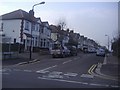
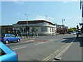
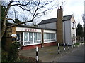
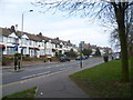

27 photos from this area
Area Information
Key information about the E17 4BJ including its size, population, and administrative classification.
- Area Type
- Postcode
- Area Size
- 8217 m²
- Population
- Not available
- Population Density
- Not available
House Prices in E17 4BJ
37
Properties
£484,244
Average Sold Price
£91,500
Lowest Price
£926,000
Highest Price
Showing 37 properties
| Address | Type | Beds | Baths | Last Sale Price | Last Sale Date | |
|---|---|---|---|---|---|---|
| 6 Woodstock Road, Walthamstow, E17 4BJ | Detached | 4 | 1 | £805,000 | Oct 2025 | |
| 70 Woodstock Road, Walthamstow, E17 4BJ | Terraced | 5 | 2 | £790,000 | Jul 2025 | |
| 32 Woodstock Road, Walthamstow, E17 4BJ | Terraced | 3 | 1 | £845,000 | Feb 2023 | |
| 4 Woodstock Road, Walthamstow, E17 4BJ | Semi-detached | 4 | 3 | £926,000 | Sep 2022 | |
| 68 Woodstock Road, Walthamstow, E17 4BJ | Terraced | 5 | 2 | £890,000 | Dec 2021 | |
| 30 Woodstock Road, Walthamstow, E17 4BJ | house | - | - | £735,000 | May 2021 | |
| 10 Woodstock Road, Walthamstow, E17 4BJ | Terraced | 3 | 1 | £450,000 | May 2020 | |
| 54B Woodstock Road, Walthamstow, E17 4BJ | Flat | - | - | £340,000 | Sep 2019 | |
| 2 Woodstock Road, Walthamstow, E17 4BJ | Terraced | 3 | 1 | £682,500 | May 2018 | |
| 16 Woodstock Road, Walthamstow, E17 4BJ | house | - | - | £425,000 | Jul 2015 |
Page 1 of 4
Energy Efficiency in E17 4BJ
Amenities
Schools
| Rank | School | Type | Entry gender | Ages |
|---|
Explore more schools in this area
Go to Schools tabDemographics
Household Size
Family (3-5 people)
most common
Accommodation Type
Houses
most common
Tenure
58
majority
Ethnic Group
White
most common
Religion
N/A
most common
Household Composition
N/A
most common
Age
47
median
Adults (30-64 years)
most common
Household Deprivation
N/A
with no deprivation
NS-SEC
37
in Lower managerial occupations
Explore more demographic insights in this area
Go to Demographics tabPlanning
Planning Constraints
- Flood RiskPremium
- Ramsar Wetland SitesPremium
- Area of Outstanding Natural BeautyPremium
- Protected Nature ReservePremium
- Protected WoodlandPremium