Area Overview for E17 4AS
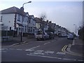
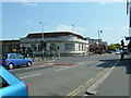
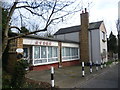
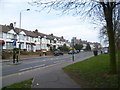
Photos of E17 4AS


Area Information
Living in E17 4AS offers a compact, residential experience shaped by its small cluster of homes and proximity to essential services. With a population of 1,849, this postcode area is a tight-knit community where daily life is influenced by nearby amenities and transport links. The area’s character is defined by its mix of local shops, schools, and public transport options, making it practical for families and commuters. Residents benefit from being close to primary schools like Thorpe Hall Primary School, which holds a good Ofsted rating, and specialist educational facilities such as Whitefield Schools and Centre. The area’s connectivity is strong, with multiple rail and metro stations within reach, including Wood Street Station and Highams Park Station. While the population is small, the presence of retail outlets like Tesco Wood and Co-op Wood ensures basic needs are met. E17 4AS is not a sprawling suburb but a focused residential zone where convenience and accessibility are prioritised, offering a quieter alternative to larger urban hubs without sacrificing practicality.
- Area Type
- Postcode
- Area Size
- Not available
- Population
- Not available
- Population Density
- Not available
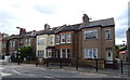
The property market in E17 4AS is characterised by a high proportion of owner-occupied homes, with 58% of properties owned by residents rather than rented. The accommodation type is predominantly houses, which is unusual for areas with higher apartment density. This suggests a market skewed towards family homes and single-occupancy properties, rather than a rental-focused area. Given the small size of the postcode, the housing stock is limited, meaning buyers should consider nearby areas for more options. The presence of houses may appeal to those seeking space and privacy, though the compact nature of E17 4AS means properties are likely to be close to amenities and transport. For buyers, this area offers a blend of stability and proximity to services, but the limited scale of the market may require a broader search for larger property selections.
House Prices in E17 4AS
No properties found in this postcode.
Energy Efficiency in E17 4AS
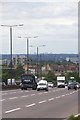
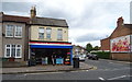
Residents of E17 4AS enjoy a range of nearby amenities that support everyday life. Local retail options include Tesco Wood, Budgens Walthamstow, and Co-op Wood, providing access to groceries and essentials. The area’s proximity to rail and metro stations, such as South Woodford and Wanstead, makes commuting straightforward, while ferry piers like East India Pier and Canary Wharf Pier offer alternative travel routes. Though the area is small, its location near larger hubs means residents can access broader leisure and dining options beyond the immediate postcode. The presence of multiple transport links and retail outlets suggests a lifestyle that balances convenience with accessibility, allowing residents to enjoy both local and wider opportunities without significant travel time.
Amenities
Schools
Residents of E17 4AS have access to a range of educational institutions, including Thorpe Hall Primary School, which holds a good Ofsted rating. This primary school provides a solid foundation for younger children, while specialist schools like Whitefield Schools and Centre cater to students with specific needs. The presence of both mainstream and special educational facilities ensures families have options depending on their children’s requirements. The proximity of these schools to the area makes E17 4AS an attractive choice for parents seeking a mix of traditional and tailored education. However, the absence of secondary schools within the postcode means families may need to look further afield for high school options. The school mix reflects a community that values both general and specialist education, supporting a diverse range of learner needs.
| Rank | School | Type | Entry gender | Ages |
|---|
Explore more schools in this area
Go to Schools tabDemographics
The community in E17 4AS is predominantly composed of adults aged 30–64, with a median age of 47. This suggests a mature population, likely with established careers and families. Home ownership is strong, with 58% of residents owning their homes, and the accommodation type is primarily houses, indicating a mix of family homes and single-occupancy properties. The predominant ethnic group is White, though no specific diversity statistics are provided. The age profile and ownership rates suggest a stable, long-term resident base rather than a transient population. The absence of data on deprivation means it is unclear how economic factors might influence quality of life, but the high home ownership rate and focus on family-friendly housing imply a community prioritising security and comfort.
Household Size
Accommodation Type
Tenure
Ethnic Group
Religion
Household Composition
Age
Household Deprivation
NS-SEC
Explore more demographic insights in this area
Go to Demographics tabPlanning
Planning Constraints
- Flood RiskPremium
- Ramsar Wetland SitesPremium
- Area of Outstanding Natural BeautyPremium
- Protected Nature ReservePremium
- Protected WoodlandPremium