Area Overview for E17 3RJ
Photos of E17 3RJ
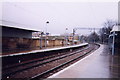
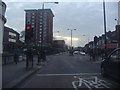
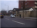
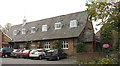
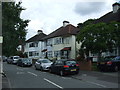
98 photos from this area
Area Information
Key information about the E17 3RJ including its size, population, and administrative classification.
- Area Type
- Postcode
- Area Size
- 3.6 hectares
- Population
- 1926
- Population Density
- 9171 people/km²
House Prices in E17 3RJ
27
Properties
£498,868
Average Sold Price
£106,000
Lowest Price
£900,000
Highest Price
Showing 27 properties
| Address | Type | Beds | Baths | Last Sale Price | Last Sale Date | |
|---|---|---|---|---|---|---|
| 24 Hillside Gardens, Walthamstow, E17 3RJ | Semi-detached | 3 | 1 | £750,000 | Oct 2024 | |
| 10 Hillside Gardens, Walthamstow, E17 3RJ | house | - | - | £500,000 | Jul 2024 | |
| 44 Hillside Gardens, Walthamstow, E17 3RJ | Semi-detached | 5 | - | £810,000 | Mar 2023 | |
| 4 Hillside Gardens, Walthamstow, E17 3RJ | Terraced | 5 | - | £900,000 | Oct 2021 | |
| 38 Hillside Gardens, Walthamstow, E17 3RJ | Semi-detached | 3 | 2 | £750,000 | Mar 2021 | |
| 22 Hillside Gardens, Walthamstow, E17 3RJ | Semi-detached | 3 | - | £625,000 | Sep 2017 | |
| 42 Hillside Gardens, Walthamstow, E17 3RJ | house | - | - | £700,000 | Jul 2016 | |
| 16 Hillside Gardens, Walthamstow, E17 3RJ | house | 4 | - | £655,000 | Jan 2016 | |
| 8 Hillside Gardens, Walthamstow, E17 3RJ | Semi-detached | 3 | 2 | £400,000 | Jan 2016 | |
| 18 Hillside Gardens, Walthamstow, E17 3RJ | house | 4 | 1 | £673,500 | Jun 2015 |
Page 1 of 3
Energy Efficiency in E17 3RJ
Amenities
Schools
| Rank | School | Type | Entry gender | Ages |
|---|
Explore more schools in this area
Go to Schools tabDemographics
Household Size
Family (3-5 people)
most common
Accommodation Type
Flats
most common
Tenure
33
majority
Ethnic Group
White
most common
Religion
N/A
most common
Household Composition
N/A
most common
Age
47
median
Adults (30-64 years)
most common
Household Deprivation
N/A
with no deprivation
NS-SEC
25
in Lower managerial occupations
Explore more demographic insights in this area
Go to Demographics tabPlanning
Planning Constraints
- Flood RiskPremium
- Ramsar Wetland SitesPremium
- Area of Outstanding Natural BeautyPremium
- Protected Nature ReservePremium
- Protected WoodlandPremium