Area Overview for E17 3LE
Photos of E17 3LE
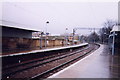
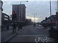
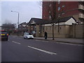
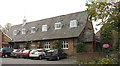
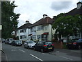
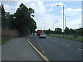
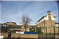
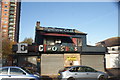
98 photos from this area
Area Information
Key information about the E17 3LE including its size, population, and administrative classification.
- Area Type
- Postcode
- Area Size
- 8532 m²
- Population
- Not available
- Population Density
- Not available
House Prices in E17 3LE
60
Properties
£358,165
Average Sold Price
£20,000
Lowest Price
£856,000
Highest Price
Showing 60 properties
| Address | Type | Beds | Baths | Last Sale Price | Last Sale Date | |
|---|---|---|---|---|---|---|
| 18 Woodlands Road, Walthamstow, E17 3LE | Terraced | 3 | 2 | £735,000 | Sep 2025 | |
| 54 Woodlands Road, Walthamstow, E17 3LE | Terraced | 3 | 2 | £856,000 | Jan 2025 | |
| 20 Woodlands Road, Walthamstow, E17 3LE | Terraced | 2 | 1 | £835,000 | Aug 2024 | |
| 12 Woodlands Road, Walthamstow, E17 3LE | Terraced | 3 | 1 | £812,000 | Mar 2023 | |
| 68 Woodlands Road, Walthamstow, E17 3LE | Terraced | 3 | 1 | £725,000 | Dec 2022 | |
| 36 Woodlands Road, Walthamstow, E17 3LE | house | - | - | £790,000 | Nov 2021 | |
| 80 Woodlands Road, Walthamstow, E17 3LE | house | - | - | £575,000 | Jun 2021 | |
| 44 Woodlands Road, Walthamstow, E17 3LE | house | - | - | £700,000 | Jun 2021 | |
| 82 Woodlands Road, Walthamstow, E17 3LE | house | - | - | £440,000 | Jan 2021 | |
| 56 Woodlands Road, Walthamstow, E17 3LE | Flat | 1 | 1 | £20,000 | Oct 2020 |
Page 1 of 6
Energy Efficiency in E17 3LE
Amenities
Schools
| Rank | School | Type | Entry gender | Ages |
|---|
Explore more schools in this area
Go to Schools tabDemographics
Household Size
Family (3-5 people)
most common
Accommodation Type
Flats
most common
Tenure
44
majority
Ethnic Group
White
most common
Religion
N/A
most common
Household Composition
N/A
most common
Age
47
median
Adults (30-64 years)
most common
Household Deprivation
N/A
with no deprivation
NS-SEC
35
in Lower managerial occupations
Explore more demographic insights in this area
Go to Demographics tabPlanning
Planning Constraints
- Flood RiskPremium
- Ramsar Wetland SitesPremium
- Area of Outstanding Natural BeautyPremium
- Protected Nature ReservePremium
- Protected WoodlandPremium