Area Overview for E17 3HY
Photos of E17 3HY
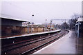
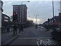
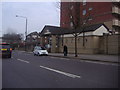
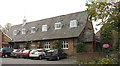
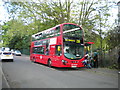
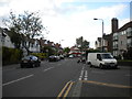
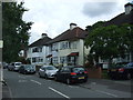
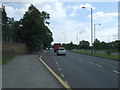
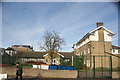
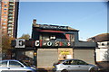
98 photos from this area
Area Information
Key information about the E17 3HY including its size, population, and administrative classification.
- Area Type
- Postcode
- Area Size
- 3114 m²
- Population
- 1671
- Population Density
- 11564 people/km²
House Prices in E17 3HY
27
Properties
£283,000
Average Sold Price
£72,000
Lowest Price
£650,000
Highest Price
Showing 27 properties
| Address | Type | Beds | Baths | Last Sale Price | Last Sale Date | |
|---|---|---|---|---|---|---|
| 21 Albion Road, Walthamstow, E17 3HY | Terraced | 2 | 1 | £650,000 | Jul 2025 | |
| 39 Albion Road, Walthamstow, E17 3HY | house | - | - | £620,000 | Aug 2024 | |
| 17 Albion Road, Walthamstow, E17 3HY | Terraced | 2 | 1 | £375,000 | Sep 2021 | |
| 3 Albion Road, Walthamstow, E17 3HY | Flat | 1 | 1 | £265,000 | Nov 2020 | |
| 23 Albion Road, Walthamstow, E17 3HY | Terraced | 3 | 2 | £465,000 | Dec 2016 | |
| 45 Albion Road, Walthamstow, E17 3HY | house | 3 | - | £190,000 | Dec 2012 | |
| 19 Albion Road, Walthamstow, E17 3HY | Terraced | - | - | £197,000 | Sep 2005 | |
| 43 Albion Road, Walthamstow, E17 3HY | house | - | - | £217,000 | Jul 2004 | |
| 13 Albion Road, Walthamstow, E17 3HY | house | 4 | 1 | £170,000 | Aug 2003 | |
| 11 Albion Road, Walthamstow, E17 3HY | house | - | - | £100,000 | May 2000 |
Page 1 of 3
Energy Efficiency in E17 3HY
Amenities
Schools
| Rank | School | Type | Entry gender | Ages |
|---|
Explore more schools in this area
Go to Schools tabDemographics
Household Size
Family (3-5 people)
most common
Accommodation Type
Houses
most common
Tenure
45
majority
Ethnic Group
White
most common
Religion
N/A
most common
Household Composition
N/A
most common
Age
47
median
Adults (30-64 years)
most common
Household Deprivation
N/A
with no deprivation
NS-SEC
36
in Lower managerial occupations
Explore more demographic insights in this area
Go to Demographics tabPlanning
Planning Constraints
- Flood RiskPremium
- Ramsar Wetland SitesPremium
- Area of Outstanding Natural BeautyPremium
- Protected Nature ReservePremium
- Protected WoodlandPremium