Area Overview for E16 4JA
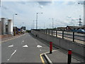
Photos of E16 4JA


Area Information
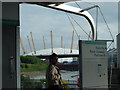
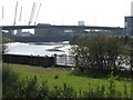
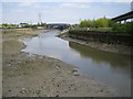
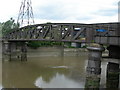
E16 4JA lies within the Canning Town district of London’s Newham borough, a historically industrial area shaped by dockland development. With a population of 1,480, this small residential cluster is characterised by post-war council housing and ongoing regeneration. The area sits north of the Royal Victoria Dock, its history marked by 19th-century urbanisation, wartime destruction, and slum clearances. Today, it is a patchwork of high-rises and estates, with pockets of newer developments planned to add up to 10,000 homes since 2012. Despite its deprived status—ranking in the second most deprived decile in the UK—it offers practical connectivity to major transport hubs, retail, and ferry services. Residents here are likely to be working-age adults, with a median age of 47, and many live in flats rather than owner-occupied homes. Daily life is shaped by proximity to Canning Town Station, which links to the DLR, Jubilee Line, and North London Line, offering swift access to Canary Wharf and central London. The area’s compact nature means amenities are within walking or short transit distance, though its character remains defined by a mix of historic infrastructure and modern regeneration efforts.
- Area Type
- Postcode
- Area Size
- Not available
- Population
- 1480
- Population Density
- 10271 people/km²
The property market in E16 4JA is dominated by flats, with home ownership at just 27%. This suggests that the area is not a strong candidate for owner-occupied buyers, as the majority of housing is rented or part of shared ownership schemes. The low home ownership rate aligns with the area’s status as a deprived ward, where property values may not reflect the broader London market. The accommodation type—flats—means that buyers seeking larger, detached homes are unlikely to find them here. Instead, the market caters to those requiring affordable rental options or shared living spaces. Given the area’s small size and proximity to regeneration projects, buyers might look to nearby wards for more varied housing stock. However, within E16 4JA, the focus remains on existing council housing and flats, which may appeal to those prioritising location over property type. The limited availability of owner-occupied homes underscores the area’s role as a transitional zone rather than a primary destination for property investment.
House Prices in E16 4JA
No properties found in this postcode.
Energy Efficiency in E16 4JA
Living in E16 4JA offers access to a range of amenities within practical reach. The area is served by five metro stations, including Canning Town and East India, which link to retail hubs like Co-op Canning, Morrisons Canning, and Sainsburys London. Ferries from East India Pier and Royal Wharf Pier provide water-based connectivity, while rail stations such as West Ham and Canary Wharf offer access to broader London. The nearby Whipps Cross Bus Interchange adds to the transport options. For daily life, residents can shop at major retailers, use public transport to reach cultural sites, and access London City Airport for travel. The area’s proximity to the Royal Victoria Dock and historic sites like Canning Town Public Hall adds a layer of local character. While the amenities are functional rather than luxurious, they support a practical lifestyle, with a focus on connectivity and convenience over high-end leisure. The compact nature of the area means residents can walk or cycle to most services, though the lack of green spaces or high-end dining reflects its working-class roots.
Amenities
Schools
| Rank | School | Type | Entry gender | Ages |
|---|
Explore more schools in this area
Go to Schools tabDemographics
The community in E16 4JA is predominantly composed of adults aged 30–64, with a median age of 47. Home ownership here is low, at 27%, indicating that most residents are either renters or live in shared accommodations. The accommodation type is overwhelmingly flats, reflecting the area’s post-war housing stock. The predominant ethnic group is White, though the ward’s history of industrial migration and regeneration suggests a diverse population. The area’s deprivation status—ranked in the second most deprived decile in the UK—correlates with challenges such as in-work poverty, poor health outcomes, and lower educational attainment. This context shapes daily life, with residents often relying on public services and community amenities. The demographic profile suggests a stable, working-age population, but the lack of high home ownership and the focus on flats indicate limited opportunities for long-term investment in property. The area’s character is further defined by its proximity to transport hubs and its role as a transitional zone between historic docklands and newer developments.
Household Size
Accommodation Type
Tenure
Ethnic Group
Religion
Household Composition
Age
Household Deprivation
NS-SEC
Explore more demographic insights in this area
Go to Demographics tabPlanning
Planning Constraints
- Flood RiskPremium
- Ramsar Wetland SitesPremium
- Area of Outstanding Natural BeautyPremium
- Protected Nature ReservePremium
- Protected WoodlandPremium