Area Overview for E16 4AL
Photos of E16 4AL
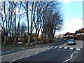
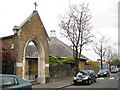
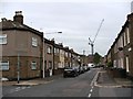
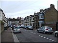
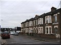
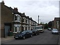
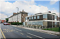
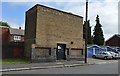
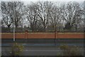
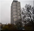
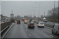
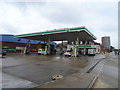
81 photos from this area
Area Information
Key information about the E16 4AL including its size, population, and administrative classification.
- Area Type
- Postcode
- Area Size
- 2975 m²
- Population
- Not available
- Population Density
- Not available
House Prices in E16 4AL
35
Properties
£175,240
Average Sold Price
£35,500
Lowest Price
£339,000
Highest Price
Showing 35 properties
| Address | Type | Beds | Baths | Last Sale Price | Last Sale Date | |
|---|---|---|---|---|---|---|
| 16 Ling Road, Canning Town, London, E16 4AL | Maisonette | 2 | 1 | £300,000 | Jun 2025 | |
| 52 Ling Road, Canning Town, London, E16 4AL | Flat | 2 | 1 | £295,000 | Nov 2023 | |
| 28 Ling Road, Canning Town, London, E16 4AL | Flat | 2 | 1 | £220,000 | May 2023 | |
| 34 Ling Road, Canning Town, London, E16 4AL | Flat | - | - | £285,000 | Jun 2022 | |
| 12 Ling Road, Canning Town, London, E16 4AL | Flat | - | - | £234,000 | Jun 2021 | |
| 38 Ling Road, Canning Town, London, E16 4AL | Flat | - | - | £160,000 | Jan 2021 | |
| 48 Ling Road, Canning Town, London, E16 4AL | Flat | - | - | £179,000 | Jan 2020 | |
| 4 Ling Road, Canning Town, London, E16 4AL | Flat | - | - | £285,000 | Nov 2019 | |
| 8 Ling Road, Canning Town, London, E16 4AL | Flat | - | - | £262,000 | Jan 2017 | |
| 2 Ling Road, Canning Town, London, E16 4AL | Terraced | 3 | 1 | £339,000 | Jul 2015 |
Page 1 of 4
Energy Efficiency in E16 4AL
Amenities
Schools
| Rank | School | Type | Entry gender | Ages |
|---|
Explore more schools in this area
Go to Schools tabDemographics
Household Size
Family (3-5 people)
most common
Accommodation Type
Flats
most common
Tenure
18
majority
Ethnic Group
White
most common
Religion
N/A
most common
Household Composition
N/A
most common
Age
47
median
Adults (30-64 years)
most common
Household Deprivation
N/A
with no deprivation
NS-SEC
19
in Lower managerial occupations
Explore more demographic insights in this area
Go to Demographics tabPlanning
Planning Constraints
- Flood RiskPremium
- Ramsar Wetland SitesPremium
- Area of Outstanding Natural BeautyPremium
- Protected Nature ReservePremium
- Protected WoodlandPremium