Area Overview for E16 3EY
Photos of E16 3EY
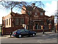


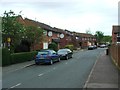
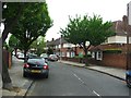
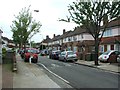
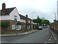
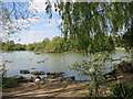
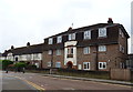
85 photos from this area
Area Information
Key information about the E16 3EY including its size, population, and administrative classification.
- Area Type
- Postcode
- Area Size
- 1.1 hectares
- Population
- 1658
- Population Density
- 9320 people/km²
House Prices in E16 3EY
66
Properties
£300,906
Average Sold Price
£117,000
Lowest Price
£490,000
Highest Price
Showing 66 properties
| Address | Type | Beds | Baths | Last Sale Price | Last Sale Date | |
|---|---|---|---|---|---|---|
| 123 Alnwick Road, West Beckton, London, E16 3EY | Terraced | 2 | 2 | £410,000 | Feb 2023 | |
| 105 Alnwick Road, West Beckton, London, E16 3EY | house | - | - | £255,000 | Nov 2022 | |
| 117 Alnwick Road, West Beckton, London, E16 3EY | house | 6 | 2 | £490,000 | Jan 2022 | |
| 101 Alnwick Road, West Beckton, London, E16 3EY | Terraced | 3 | 1 | £480,000 | Sep 2020 | |
| 225 Alnwick Road, West Beckton, London, E16 3EY | Flat | - | - | £207,500 | Dec 2019 | |
| 175 Alnwick Road, West Beckton, London, E16 3EY | Flat | 1 | 1 | £218,000 | Apr 2018 | |
| 215 Alnwick Road, West Beckton, London, E16 3EY | Flat | - | - | £270,000 | Oct 2017 | |
| 133 Alnwick Road, West Beckton, London, E16 3EY | Terraced | 7 | 3 | £430,000 | May 2017 | |
| 137 Alnwick Road, West Beckton, London, E16 3EY | house | 3 | - | £385,000 | Aug 2016 | |
| 115 Alnwick Road, West Beckton, London, E16 3EY | Terraced | 4 | 3 | £420,000 | Sep 2015 |
Page 1 of 7
Energy Efficiency in E16 3EY
Amenities
Schools
| Rank | School | Type | Entry gender | Ages |
|---|
Explore more schools in this area
Go to Schools tabDemographics
Household Size
Family (3-5 people)
most common
Accommodation Type
Houses
most common
Tenure
23
majority
Ethnic Group
White
most common
Religion
N/A
most common
Household Composition
N/A
most common
Age
47
median
Adults (30-64 years)
most common
Household Deprivation
N/A
with no deprivation
NS-SEC
19
in Lower managerial occupations
Explore more demographic insights in this area
Go to Demographics tabPlanning
Planning Constraints
- Flood RiskPremium
- Ramsar Wetland SitesPremium
- Area of Outstanding Natural BeautyPremium
- Protected Nature ReservePremium
- Protected WoodlandPremium