Area Overview for E16 3DS
Photos of E16 3DS


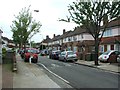
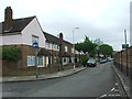
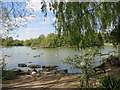
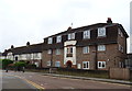
85 photos from this area
Area Information
Key information about the E16 3DS including its size, population, and administrative classification.
- Area Type
- Postcode
- Area Size
- 1.3 hectares
- Population
- Not available
- Population Density
- Not available
House Prices in E16 3DS
80
Properties
£230,300
Average Sold Price
£20,000
Lowest Price
£435,000
Highest Price
Showing 80 properties
| Address | Type | Beds | Baths | Last Sale Price | Last Sale Date | |
|---|---|---|---|---|---|---|
| 84 Berwick Road, Canning Town, London, E16 3DS | house | - | - | £410,000 | Sep 2021 | |
| 14 Berwick Road, Canning Town, London, E16 3DS | Maisonette | 2 | 1 | £310,000 | May 2020 | |
| 28 Berwick Road, Canning Town, London, E16 3DS | Maisonette | 3 | 1 | £330,000 | May 2019 | |
| 74 Berwick Road, Canning Town, London, E16 3DS | house | - | - | £435,000 | Sep 2018 | |
| 76 Berwick Road, Canning Town, London, E16 3DS | house | 3 | 1 | £400,000 | Nov 2016 | |
| 32 Berwick Road, Canning Town, London, E16 3DS | Maisonette | 3 | - | £345,000 | Jul 2016 | |
| 22 Berwick Road, Canning Town, London, E16 3DS | Maisonette | 3 | 1 | £320,000 | Feb 2016 | |
| 14A Berwick Road, Canning Town, London, E16 3DS | Maisonette | 3 | 1 | £210,000 | Oct 2015 | |
| 12A Berwick Road, Canning Town, London, E16 3DS | Maisonette | - | - | £170,000 | Dec 2013 | |
| 68 Berwick Road, Canning Town, London, E16 3DS | house | - | - | £200,000 | Feb 2012 |
Page 1 of 8
Energy Efficiency in E16 3DS
Amenities
Schools
| Rank | School | Type | Entry gender | Ages |
|---|
Explore more schools in this area
Go to Schools tabDemographics
Household Size
One person
most common
Accommodation Type
Flats
most common
Tenure
22
majority
Ethnic Group
White
most common
Religion
N/A
most common
Household Composition
N/A
most common
Age
47
median
Adults (30-64 years)
most common
Household Deprivation
N/A
with no deprivation
NS-SEC
20
in Lower managerial occupations
Explore more demographic insights in this area
Go to Demographics tabPlanning
Planning Constraints
- Flood RiskPremium
- Ramsar Wetland SitesPremium
- Area of Outstanding Natural BeautyPremium
- Protected Nature ReservePremium
- Protected WoodlandPremium