Area Overview for E16 2SL
Photos of E16 2SL


Area Information
E16 2SL is a compact residential postcode in east London, home to 1409 residents. The area is defined by its proximity to transport hubs, including multiple DLR stations and rail links, which make it a convenient base for commuters. The population skews toward adults aged 30–64, reflecting a mature community. Daily life here is shaped by the availability of nearby amenities, from supermarkets like Budgens Silvertown to ferry piers offering access to the Thames. The area’s small size means it is tightly integrated with surrounding districts, yet it retains a distinct identity through its mix of residential flats and proximity to London City Airport. With broadband scores near perfect and mobile coverage rated good, residents enjoy reliable digital connectivity. While crime rates are average, the absence of environmental constraints such as protected woodlands or flood zones adds to the area’s appeal. Living in E16 2SL offers a balance of urban convenience and practicality, ideal for those prioritising accessibility over sprawling green spaces.
- Area Type
- Postcode
- Area Size
- Not available
- Population
- Not available
- Population Density
- Not available
The property market in E16 2SL is characterised by a low home ownership rate of 24%, indicating that the area is primarily a rental market. The predominant accommodation type is flats, which aligns with the postcode’s compact, residential nature. This suggests that the housing stock is suited to individuals or couples seeking smaller, manageable spaces rather than larger family homes. For buyers considering the area, the limited number of owner-occupied properties may present opportunities for investment, though the market is unlikely to cater to those seeking detached housing. The small size of E16 2SL means that property values and availability are closely tied to the surrounding districts. Prospective buyers should also consider the area’s reliance on public transport, as the lack of private housing options may influence long-term residency plans. The focus on flats also means that buyers should evaluate whether the layout and size of available properties meet their specific needs.
House Prices in E16 2SL
No properties found in this postcode.
Energy Efficiency in E16 2SL
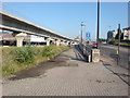
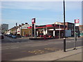
Living in E16 2SL offers a blend of practicality and accessibility, with amenities clustered within easy reach. Retail options include Budgens Silvertown, Sainsburys Newham, and Tesco Royal, catering to daily shopping needs. The area’s transport links extend beyond commuting, with ferry piers like Royal Wharf Pier and Barrier Gardens Pier providing access to the Thames for leisure or travel. DLR stations such as West Silvertown and Pontoon Dock connect residents to London’s cultural and commercial hubs, while rail services at Custom House and Charlton stations offer broader regional access. The proximity to London City Airport adds to the area’s appeal for those requiring frequent travel. Despite its compact size, E16 2SL’s density of services ensures that residents can access shops, transport, and leisure facilities without needing to travel far. The mix of retail, transport, and waterfront access contributes to a convenient, urban lifestyle, though the lack of large parks or green spaces may be a consideration for those prioritising outdoor recreation.
Amenities
Schools
| Rank | School | Type | Entry gender | Ages |
|---|
Explore more schools in this area
Go to Schools tabDemographics
The population of E16 2SL is 1409, with a median age of 47. The majority of residents fall within the 30–64 age range, indicating a community of established professionals and families. Home ownership is relatively low at 24%, suggesting that most residents rent their properties. The accommodation type is predominantly flats, reflecting the area’s density and likely influence by its proximity to transport infrastructure. The predominant ethnic group is White, though specific diversity metrics are not detailed in the data. The age profile implies a stable, long-term resident base, with fewer young families or elderly populations. This demographic structure may influence local services and amenities, which are tailored to the needs of working-age adults. The lack of data on deprivation means that quality of life factors such as access to healthcare or leisure facilities cannot be assessed here, but the presence of multiple retail and transport options suggests a reasonably well-served community.
Household Size
Accommodation Type
Tenure
Ethnic Group
Religion
Household Composition
Age
Household Deprivation
NS-SEC
Explore more demographic insights in this area
Go to Demographics tabPlanning
Planning Constraints
- Flood RiskPremium
- Ramsar Wetland SitesPremium
- Area of Outstanding Natural BeautyPremium
- Protected Nature ReservePremium
- Protected WoodlandPremium