Area Overview for E16 2LS
Photos of E16 2LS


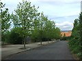
100 photos from this area
Area Information
Key information about the E16 2LS including its size, population, and administrative classification.
- Area Type
- Postcode
- Area Size
- 6328 m²
- Population
- 1961
- Population Density
- 13082 people/km²
House Prices in E16 2LS
45
Properties
£195,350
Average Sold Price
£122,000
Lowest Price
£275,000
Highest Price
Showing 45 properties
| Address | Type | Beds | Baths | Last Sale Price | Last Sale Date | |
|---|---|---|---|---|---|---|
| 76 Woodman Street, North Woolwich, London, E16 2LS | Flat | - | - | £232,500 | Jul 2024 | |
| 40 Woodman Street, North Woolwich, London, E16 2LS | Flat | - | - | £275,000 | Mar 2016 | |
| 50 Woodman Street, North Woolwich, London, E16 2LS | Flat | 2 | 1 | £240,000 | Mar 2016 | |
| 48 Woodman Street, North Woolwich, London, E16 2LS | Flat | - | - | £215,000 | Feb 2016 | |
| 60A Woodman Street, North Woolwich, London, E16 2LS | Flat | 1 | 1 | £210,000 | Dec 2015 | |
| 66A Woodman Street, North Woolwich, London, E16 2LS | Flat | 2 | 1 | £195,000 | Jun 2015 | |
| 42 Woodman Street, North Woolwich, London, E16 2LS | Flat | - | - | £168,000 | Oct 2011 | |
| 60 Woodman Street, North Woolwich, London, E16 2LS | Flat | 1 | 1 | £158,000 | Feb 2008 | |
| 54 Woodman Street, North Woolwich, London, E16 2LS | Flat | 1 | 1 | £122,000 | Nov 2006 | |
| 72 Woodman Street, North Woolwich, London, E16 2LS | Flat | - | - | £138,000 | Sep 2006 |
Page 1 of 5
Energy Efficiency in E16 2LS
Amenities
Schools
| Rank | School | Type | Entry gender | Ages |
|---|
Explore more schools in this area
Go to Schools tabDemographics
Household Size
Family (3-5 people)
most common
Accommodation Type
Flats
most common
Tenure
16
majority
Ethnic Group
black_total
most common
Religion
N/A
most common
Household Composition
N/A
most common
Age
47
median
Adults (30-64 years)
most common
Household Deprivation
N/A
with no deprivation
NS-SEC
20
in Lower managerial occupations
Explore more demographic insights in this area
Go to Demographics tabPlanning
Planning Constraints
- Flood RiskPremium
- Ramsar Wetland SitesPremium
- Area of Outstanding Natural BeautyPremium
- Protected Nature ReservePremium
- Protected WoodlandPremium