Area Overview for E16 1QX
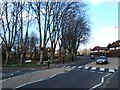
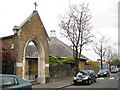
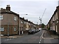
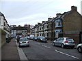
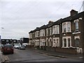
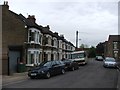
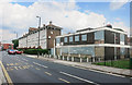
Photos of E16 1QX
Area Information
E16 1QX is a tightly packed residential cluster covering just 2,976 square metres in England. Despite its small physical footprint, the postcode supports 1,884 residents, resulting in an intense population density of 633,006 people per square kilometre. This high concentration defines the daily rhythm of the area, where residents rely heavily on shared infrastructure and nearby transport links. Living in this specific postcode means navigating a neighbourhood where space is at a premium, yet connectivity remains a central feature of life. The area functions as a dense pocket within the wider E16 postcode zone, offering direct access to major hubs without providing extensive green belts within its own boundaries. Homes in E16 1QX operate within a high-density environment that necessitates strong public transport connections for commuting. Daily life revolves around proximity to Commercial and Leisure centres, as the area itself contains limited open space for recreational activities. You will find that convenience outweighs seclusion when choosing this location, making it a practical choice for those prioritising transport efficiency over expansive grounds.
- Area Type
- Postcode
- Area Size
- 2976 m²
- Population
- 1884
- Population Density
- 6863 people/km²
The housing market in E16 1QX is characterised by a landscape where rental demand outweighs owner occupation. Only 24% of residents own their homes, meaning the remaining 76% rent their properties. Houses constitute the primary accommodation type in this sector, distinguishing it from other nearby postcodes that may feature predominately flats or terraced properties. This high proportion of private renting suggests a dynamic market where tenancy agreements play a significant role in how the area functions. Buyers looking at homes in E16 1QX should understand that they are entering a sector with limited owner-occupied stock. The prevalence of houses rather than apartments indicates a layout adapted for ground-level living despite the high density figures. Sellers in this area may find movement slower than in pure rental hubs because tenure types differ from the broader London average. If you plan to purchase, your chance of finding an owner-occupied property is slim, as most dwellings remain within the rental market portfolio.
House Prices in E16 1QX
No properties found in this postcode.
Energy Efficiency in E16 1QX
Residents of E16 1QX enjoy immediate access to extensive transport networks and retail options. Five rail stations, including Custom House Station, West Ham Station, and Canary Wharf Railway Station, are located within practical reach. Metro services connect you to Royal Victoria Station, Canning Town, IFS Cloud, and the Royal Docks. London City Airport sits within easy distance, offering quick regional travel. Five ferry locations, such as North Greenwich Pier, East India Pier, and Royal Wharf Pier, provide alternative river crossings. Retail choices are plentiful with five nearby Iceland supermarkets serving different address codes. The Whipps Cross Bus Interchange provides additional bus connectivity for local journeys. Homes in E16 1QX are surrounded by this extensive web of travel and shopping. Daily life involves easily reaching work in the financial district or the airport via these direct links. You will find that your choices for commuting and grocery shopping expand significantly beyond the 2,976 square metre footprint of your immediate postcode.
Amenities
Schools
Families residing in E16 1QX have access to a variety of educational institutions within practical reach. Rosetta Primary School holds an Ofsted rating of outstanding and serves as a key educational facility for the area. The name Rosetta appears on multiple entries, indicating Rosetta Primary School and Rosetta Infant School operate in close proximity to each other. Edith Kerrison Nursery School is also listed as a nearby option for younger children. These institutions provide a mix of nurseries and primary education, catering to children from infancy through to the end of primary schooling. Living in E16 1QX means placing schools like Rosetta Primary School at the centre of your children's upbringing. The presence of multiple entities with the name Rosetta suggests a focused educational cluster dedicated to local families. You will find that the local school list relies heavily on these specific names, with no secondary institutions listed in the immediate data. This concentration of primary and nursery provision means that families often plan their school run around these specific locations rather than a broader district catchment.
| Rank | School | Type | Entry gender | Ages |
|---|
Explore more schools in this area
Go to Schools tabDemographics
The community in E16 1QX is defined by a mature demographic profile with a median age of 47 years. Adults between the ages of 30 and 64 years form the most common age range within the population. This age structure suggests a neighbourhood dominated by established households rather than young families or students. Home ownership stands at a relatively low level of 24%, indicating that the majority of residents are likely tenants rather than property owners. Houses remain the predominant accommodation type available in this sector, contrasting with the high-rise living found elsewhere in the London Docklands area. The predominant ethnic group is White, reflecting the established character of the locality. You should expect a neighbourhood where long-term residents make up the majority of the population, creating a stable social atmosphere. The low ownership rate suggests tenants may struggle to customise their homes compared to owner-occupiers in surrounding districts. Landlords and rental agencies control the majority of the housing stock, which can influence the pace of interior maintenance and upgrades in the area.
Household Size
Accommodation Type
Tenure
Ethnic Group
Religion
Household Composition
Age
Household Deprivation
NS-SEC
Explore more demographic insights in this area
Go to Demographics tabPlanning
Planning Constraints
- Flood RiskPremium
- Ramsar Wetland SitesPremium
- Area of Outstanding Natural BeautyPremium
- Protected Nature ReservePremium
- Protected WoodlandPremium