Area Overview for E16 1LZ
Photos of E16 1LZ

Area Information
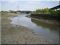
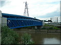
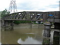
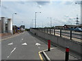
E16 1LZ is a small residential postcode in east London, nestled within the Canning Town district of Newham. With a population of 1,941, it reflects a compact, historically working-class community shaped by its dockland origins. The area’s character is defined by post-war council housing and ongoing regeneration, with developments like the Keir Hardie Estate standing as remnants of mid-20th-century urban planning. Despite its compact size, E16 1LZ is strategically positioned near key transport hubs, including Canning Town station, which links to the DLR, Jubilee Line, and North London Line. This connectivity offers swift access to Canary Wharf, the Royal Victoria Dock, and London City Airport. The area’s proximity to the 2012 Olympic Park and its mix of retail, leisure, and transport options create a dynamic environment for those seeking affordability without sacrificing accessibility. However, its location in the second most deprived decile of the UK underscores the challenges of in-work poverty and limited public services. For buyers, E16 1LZ offers a snapshot of London’s evolving urban fabric, where historic housing meets modern infrastructure.
- Area Type
- Postcode
- Area Size
- Not available
- Population
- 1941
- Population Density
- 12969 people/km²
The property market in E16 1LZ is dominated by rental flats, with only 17% of homes owned by residents. This low home ownership rate indicates a market heavily skewed toward private and social renting, with limited opportunities for buyers seeking owner-occupied properties. The prevalence of flats, a product of post-war housing policies, means the area lacks the detached homes or larger family residences common in less deprived parts of London. For buyers, this presents a challenge: the small area and its immediate surroundings offer few options for purchase, and those available are likely to be in older, council-built stock. The focus on rental housing also suggests limited capital growth potential, though proximity to transport links and regeneration projects may offer long-term value. Buyers should consider the area’s affordability in the context of its deprivation profile, balancing lower prices with the need for investment in home improvements or private services.
House Prices in E16 1LZ
Showing 1 properties
| Address | Type | Beds | Baths | Last Sale Price | Last Sale Date | |
|---|---|---|---|---|---|---|
| Flat B, River Christian Centre, Vincent Street, Canning Town, London, E16 1LZ | Flat | - | - | - | - |
Energy Efficiency in E16 1LZ
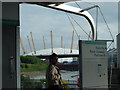
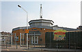
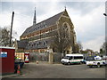
Living in E16 1LZ offers a blend of practical amenities and urban convenience. Nearby retail options include Morrisons, Budgens, and Iceland in Canning, providing essential shopping for groceries and household goods. The area’s transport links ensure easy access to leisure and dining, with the Royal Victoria Dock and nearby Olympic Park offering recreational spaces. Canning Town Public Hall, built in 1894, hosts community events, while a small park commemorates a historic meeting between Gandhi and Chaplin. The proximity to London City Airport and major rail stations enhances mobility for commuters. However, the area’s focus on retail and transport over leisure facilities means residents may need to travel for more specialized amenities. The mix of shops, transport, and community spaces creates a functional lifestyle, though the lack of green spaces and cultural venues within the postcode itself is a notable limitation.
Amenities
Schools
E16 1LZ is served by a range of educational institutions, including Oasis Nursery School, a nursery providing early years education, and St Luke’s Primary School, which holds a ‘good’ Ofsted rating. The latter offers a solid foundation for younger children, though its primary focus limits options for older students. Learningsure College, an independent school, caters to those seeking alternative education pathways. The mix of nursery, primary, and independent schools provides families with choices, though the absence of secondary schools in the immediate vicinity may require commuting. The ‘good’ rating at St Luke’s suggests a reliable local primary option, but parents seeking comprehensive schooling for all age groups may need to look beyond E16 1LZ. The diversity of school types reflects the area’s blend of public and private education options, though the lack of a full school network is a practical consideration for families.
| Rank | School | Type | Entry gender | Ages |
|---|
Explore more schools in this area
Go to Schools tabDemographics
The population of E16 1LZ is predominantly adults aged 30–64, with a median age of 47. This reflects a mature community, though the 17% home ownership rate suggests most residents are renters, a trend common in areas with high deprivation. The accommodation type is overwhelmingly flats, a legacy of post-war council housing. The predominant ethnic group is White, though the area’s history of industrial migration and regeneration implies a diverse, though not explicitly quantified, ethnic mix. The median age and age range indicate a community with established careers and families, but limited intergenerational diversity. The 17% home ownership rate, coupled with the area’s second-most-deprived status, points to limited wealth accumulation and reliance on social housing. This context shapes daily life: public services and amenities are stretched, and residents often face challenges in accessing higher education or private healthcare. The mix of age groups and housing types suggests a community that is stable but under pressure from economic constraints.
Household Size
Accommodation Type
Tenure
Ethnic Group
Religion
Household Composition
Age
Household Deprivation
NS-SEC
Explore more demographic insights in this area
Go to Demographics tabPlanning
Planning Constraints
- Flood RiskPremium
- Ramsar Wetland SitesPremium
- Area of Outstanding Natural BeautyPremium
- Protected Nature ReservePremium
- Protected WoodlandPremium