Area Overview for E15 4RG
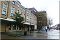
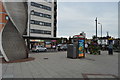
Photos of E15 4RG


Area Information
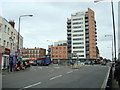
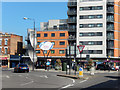
E15 4RG is a small, tightly knit residential cluster in east London, home to 2,269 people. It sits in a transitional zone between suburban calm and urban dynamism, with easy access to Stratford’s transport hubs and retail corridors. The area’s character is defined by its proximity to major infrastructure, including rail, metro, and ferry links, which make it a practical base for commuters. Daily life here balances quiet living with connectivity, with residents able to reach London City Airport, Canary Wharf, and central London within minutes. The population, predominantly adults aged 30–64, suggests a mature, settled community. While the area is compact, its strategic location near Stratford International Station and the A13 motorway ensures it is well integrated into the broader London transport network. For those seeking a blend of accessibility and residential tranquillity, E15 4RG offers a unique position at the edge of London’s growth corridors.
- Area Type
- Postcode
- Area Size
- Not available
- Population
- 2269
- Population Density
- 14146 people/km²
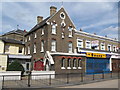
E15 4RG’s property market is characterised by a low home ownership rate of 32%, indicating that most properties are rented rather than owner-occupied. The accommodation type is predominantly houses, which is unusual for a London postcode of this size. This suggests a mix of older, possibly larger homes and newer developments, though the small area means the housing stock is limited. Buyers should consider that the area is not a traditional owner-occupied market, with rental demand likely driven by proximity to transport links. For those seeking a house, the availability is constrained by the postcode’s small size, but the presence of houses may appeal to those prioritising space over central London’s high-rise apartments.
House Prices in E15 4RG
Showing 1 properties
| Address | Type | Beds | Baths | Last Sale Price | Last Sale Date | |
|---|---|---|---|---|---|---|
| Jones And Partners, Third Floor Right Rear, Solar House, 1-9 Romford Road, Stratford, London, E15 4RG | Office | - | - | - | - |
Energy Efficiency in E15 4RG
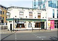
E15 4RG’s proximity to major retail and transport hubs shapes its lifestyle. Nearby shops include Morrisons Stratford, Iceland Stratford 2, and Sainsburys Stratford, providing essential grocery and retail needs. The area’s rail, metro, and ferry links ensure easy access to London’s cultural and commercial centres, from Canary Wharf to the South Bank. Residents can reach London City Airport in minutes, while Stratford’s leisure options, including the Stratford Market and nearby parks, offer recreational spaces. The combination of retail, transport, and leisure facilities makes daily life convenient, with minimal need to travel far for amenities.
Amenities
Schools
The nearest school to E15 4RG is Sarah Bonnell School, which operates as both a primary school and an academy with an Ofsted rating of ‘good’. This dual designation means it serves multiple age groups, offering a continuum of education for families. The school’s ‘good’ rating suggests it meets or exceeds national standards in teaching and outcomes. For parents, this provides a single, well-regarded institution for early years through primary education. The absence of other schools in the data implies that Sarah Bonnell School is the primary educational resource for the area, making it a key factor for families considering E15 4RG.
| Rank | School | Type | Entry gender | Ages |
|---|
Explore more schools in this area
Go to Schools tabDemographics
The population of E15 4RG has a median age of 47, with the majority of residents falling within the 30–64 age range. This indicates a community of established professionals and families, rather than a transient or student population. Home ownership here is relatively low at 32%, suggesting a higher proportion of renters compared to owner-occupied homes. The predominant accommodation type is houses, which is uncommon in densely populated areas of London, hinting at a mix of older properties and newer developments. The predominant ethnic group is White, though specific data on diversity is not provided. The age profile and ownership figures suggest a community that may prioritise convenience over property investment, with residents likely to be commuters or those seeking proximity to transport hubs.
Household Size
Accommodation Type
Tenure
Ethnic Group
Religion
Household Composition
Age
Household Deprivation
NS-SEC
Explore more demographic insights in this area
Go to Demographics tabPlanning
Planning Constraints
- Flood RiskPremium
- Ramsar Wetland SitesPremium
- Area of Outstanding Natural BeautyPremium
- Protected Nature ReservePremium
- Protected WoodlandPremium