Area Overview for E15 4EW
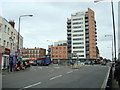
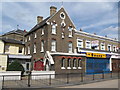
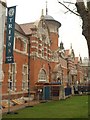
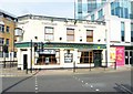
Photos of E15 4EW


Area Information
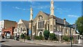
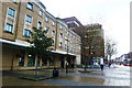
Living in E15 4EW means inhabiting a small, tightly knit residential cluster in East London’s Forest Gate South ward. With a population of 1,899, the area is characterised by Victorian terraced houses, brick-built properties, and a mix of small parks and commercial streets. Situated near the coordinates 51.54596, 0.01387, it lies south of Woodford Road, blending historical architecture with modern convenience. The area’s name, Forest Gate, originates from a 17th-century structure that once controlled livestock movement from Epping Forest. Today, it is a bustling suburb with a mature community, where 38% of residents own their homes. Daily life here is shaped by proximity to retail hubs like Tesco Stratford and transport links such as Stratford Station, offering easy access to London’s central districts. The area’s mix of historic estates, like the Woodgrange Conservation Area, and practical amenities makes it appealing to those seeking a balance between heritage and modernity.
- Area Type
- Postcode
- Area Size
- Not available
- Population
- 1899
- Population Density
- 19417 people/km²
The property market in E15 4EW is defined by its mix of owner-occupied and rental homes, with 38% of properties owned by residents. The accommodation type is largely houses, reflecting the area’s heritage of Victorian terraced buildings and historic estates such as Woodgrange. This contrasts with newer developments that often feature flats or apartments. The predominance of houses suggests a focus on family-friendly living, though the small population and limited housing stock may mean competition for available properties. Buyers should consider the area’s compact size and the potential for limited new developments. The presence of conservation areas, like Woodgrange, adds value to properties but may restrict alterations. For those seeking a traditional London suburb with historical character, E15 4EW offers a distinct option, though its small size means proximity to nearby areas like Stratford or Plaistow may be necessary for broader choices.
House Prices in E15 4EW
No properties found in this postcode.
Energy Efficiency in E15 4EW
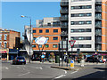
The lifestyle in E15 4EW is shaped by its proximity to retail, leisure, and transport hubs. Nearby amenities include major supermarkets such as Tesco Stratford, Sainsburys Stratford, and Morrisons Stratford, ensuring easy access to groceries and daily essentials. The area’s rail and metro stations—Forest Gate, Stratford, and Abbey Road DLR—offer swift connections to London’s commercial and cultural centres. Parks like Plashet Park, opened in 1891, provide green spaces for recreation, while historic sites such as the Woodgrange Conservation Area add character. The presence of London City Airport and ferry piers like North Greenwich Pier highlights the area’s strategic location. Residents benefit from a blend of practicality and heritage, with Victorian architecture coexisting with modern convenience. This mix of amenities fosters a dynamic yet grounded lifestyle, ideal for those valuing accessibility and historical charm.
Amenities
Schools
Residents of E15 4EW have access to two primary schools: Park Primary School and Park Infant School. Park Primary School holds a ‘good’ Ofsted rating, indicating a solid educational standard for children aged 4–11. Park Infant School, while not rated, serves younger pupils, likely from nursery to Year 2. The presence of two primary schools within close proximity suggests a focus on early education, which is vital for families with young children. Both schools are likely to be well-integrated into the local community, offering structured learning environments. The mix of school types ensures coverage for different age groups, though secondary education options are not specified in the data. For families prioritising primary schooling, the availability of these institutions is a key advantage of living in E15 4EW.
| Rank | School | Type | Entry gender | Ages |
|---|
Explore more schools in this area
Go to Schools tabDemographics
The demographic profile of E15 4EW reflects a mature, stable community. The median age is 47, with the most common age range being adults aged 30–64. This suggests a population skewed towards middle-aged individuals and families, likely established in their careers and communities. Home ownership stands at 38%, indicating that nearly two-thirds of residents rent their homes. The accommodation type is predominantly houses, which aligns with the area’s historic development of terraced properties. The predominant ethnic group is White, though specific diversity metrics are not provided. The relatively low population—under 2,000—suggests a compact, close-knit neighbourhood where social ties may be strong. The age profile implies a community with a focus on stability, potentially attracting professionals and families seeking a quieter suburban environment within London’s reach.
Household Size
Accommodation Type
Tenure
Ethnic Group
Religion
Household Composition
Age
Household Deprivation
NS-SEC
Explore more demographic insights in this area
Go to Demographics tabPlanning
Planning Constraints
- Flood RiskPremium
- Ramsar Wetland SitesPremium
- Area of Outstanding Natural BeautyPremium
- Protected Nature ReservePremium
- Protected WoodlandPremium