Area Overview for E15 3RA
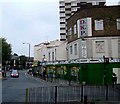
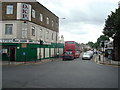
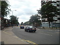
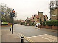
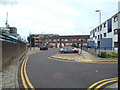
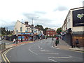
Photos of E15 3RA


Area Information
E15 3RA is a small residential postcode area in England, home to 1894 people. It is a tightly knit cluster of properties, reflecting a community that prioritises proximity to essential services and transport links. The area’s compact size means residents have easy access to local amenities, though the housing stock is limited in scale. Daily life here is shaped by its location, with a balance of residential calm and urban connectivity. The median age of 47 suggests a mature population, with many residents in their 30s to 60s. This demographic likely influences the area’s character, with a focus on practical living over sprawling development. The postcode’s small footprint means it is not a destination for large-scale housing projects, but rather a place where established communities thrive. For those considering E15 3RA, the appeal lies in its manageable size, combined with the convenience of nearby transport hubs and retail options. It is not a place for those seeking vast estates, but rather a compact, functional area suited to those valuing accessibility over expansive space.
- Area Type
- Postcode
- Area Size
- Not available
- Population
- 1894
- Population Density
- 26379 people/km²
The property market in E15 3RA is characterised by a low home ownership rate of 20%, which suggests that the area is not primarily owner-occupied but rather a rental market. The accommodation type is predominantly flats, which is typical of smaller residential clusters where space is limited. This means the housing stock is likely to consist of multi-unit buildings, possibly older properties or developments designed for high-density living. For buyers, this presents a challenge: the limited number of owner-occupied homes may restrict availability, and the focus on flats could mean fewer options for those seeking larger properties. However, the area’s proximity to transport links and amenities may make it attractive to investors or those prioritising convenience over property size. The small scale of the area also means that the immediate surroundings are critical—buyers should consider nearby postcode areas for more diverse housing options.
House Prices in E15 3RA
No properties found in this postcode.
Energy Efficiency in E15 3RA
The lifestyle in E15 3RA is shaped by its proximity to a variety of amenities. Retail options include Co-op Newham, Tesco New, and Tesco Upton Park, providing essential shopping needs within walking or short transit distance. The area’s transport network ensures that residents can access leisure and dining opportunities beyond the immediate postcode, though local specifics are not detailed in the data. The presence of ferry services and nearby airports suggests a connection to both urban and coastal activities. While the data does not specify parks or recreational spaces, the area’s transport links to larger hubs imply access to green spaces and cultural attractions in nearby regions. The combination of retail, transport, and connectivity creates a functional lifestyle, where daily needs are met efficiently, and the area’s small size fosters a sense of community.
Amenities
Schools
E15 3RA is served by three primary schools, with Portway Primary School holding an outstanding Ofsted rating. The presence of multiple primary schools suggests that the area is well-suited for families with young children, offering a range of educational options. Portway Junior School and the other Portway Primary School are additional choices, though the exact distinction between them is not specified in the data. The outstanding rating at one of the schools indicates a high standard of education, which could be a key factor for families prioritising academic quality. However, the absence of secondary schools in the immediate vicinity means that students may need to travel further for secondary education. This mix of primary schools provides flexibility for parents, but the lack of comprehensive schooling within the area may influence long-term family planning.
| Rank | School | Type | Entry gender | Ages |
|---|
Explore more schools in this area
Go to Schools tabDemographics
The population of E15 3RA is predominantly adults aged 30–64, with a median age of 47. This suggests a mature, settled community, likely with families and professionals in their prime working years. Home ownership is relatively low at 20%, indicating that a significant portion of residents rent their homes. The accommodation type is primarily flats, which aligns with the area’s compact nature and may reflect a mix of older housing stock and purpose-built residential blocks. The predominant ethnic group is Asian_total, which contributes to the area’s cultural diversity. This demographic profile shapes the local economy and social dynamics, with a focus on community cohesion and shared resources. The low home ownership rate may also suggest a reliance on rental markets, which could influence property values and investment opportunities. For buyers, understanding this demographic context is crucial, as it informs the type of housing available and the potential for long-term stability in the area.
Household Size
Accommodation Type
Tenure
Ethnic Group
Religion
Household Composition
Age
Household Deprivation
NS-SEC
Explore more demographic insights in this area
Go to Demographics tabPlanning
Planning Constraints
- Flood RiskPremium
- Ramsar Wetland SitesPremium
- Area of Outstanding Natural BeautyPremium
- Protected Nature ReservePremium
- Protected WoodlandPremium