Area Overview for E15 2AT
Photos of E15 2AT
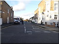
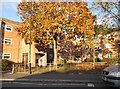
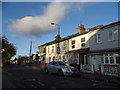
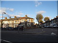
90 photos from this area
Area Information
Key information about the E15 2AT including its size, population, and administrative classification.
- Area Type
- Postcode
- Area Size
- 7520 m²
- Population
- 1742
- Population Density
- 15254 people/km²
House Prices in E15 2AT
58
Properties
£249,347
Average Sold Price
£125,000
Lowest Price
£520,000
Highest Price
Showing 58 properties
| Address | Type | Beds | Baths | Last Sale Price | Last Sale Date | |
|---|---|---|---|---|---|---|
| 214 Crownfield Road, Stratford, E15 2AT | Flat | - | - | £255,000 | Nov 2025 | |
| 204 Crownfield Road, Stratford, E15 2AT | Flat | - | - | £258,625 | Jul 2024 | |
| 142 Crownfield Road, Stratford, E15 2AT | Semi-detached | 2 | 1 | £520,000 | Feb 2024 | |
| 140 Crownfield Road, Stratford, E15 2AT | Semi-detached | 1 | 1 | £465,000 | Jan 2022 | |
| 158 Crownfield Road, Stratford, E15 2AT | Flat | - | - | £125,000 | Oct 2019 | |
| 194 Crownfield Road, Stratford, E15 2AT | Flat | - | - | £160,000 | Sep 2010 | |
| 170 Crownfield Road, Stratford, E15 2AT | Flat | - | - | £150,000 | Mar 2009 | |
| 162 Crownfield Road, Stratford, E15 2AT | house | - | - | £165,000 | Feb 2008 | |
| 236 Crownfield Road, Stratford, E15 2AT | Flat | - | - | £145,500 | Dec 2004 | |
| 246 Crownfield Road, Stratford, E15 2AT | Maisonette | 1 | 1 | - | - |
Page 1 of 6
Energy Efficiency in E15 2AT
Amenities
Schools
| Rank | School | Type | Entry gender | Ages |
|---|
Explore more schools in this area
Go to Schools tabDemographics
Household Size
Family (3-5 people)
most common
Accommodation Type
Houses
most common
Tenure
34
majority
Ethnic Group
White
most common
Religion
N/A
most common
Household Composition
N/A
most common
Age
47
median
Adults (30-64 years)
most common
Household Deprivation
N/A
with no deprivation
NS-SEC
27
in Lower managerial occupations
Explore more demographic insights in this area
Go to Demographics tabPlanning
Planning Constraints
- Flood RiskPremium
- Ramsar Wetland SitesPremium
- Area of Outstanding Natural BeautyPremium
- Protected Nature ReservePremium
- Protected WoodlandPremium