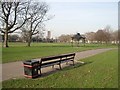
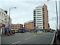
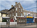
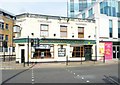
Area Overview for E15 1HP
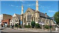
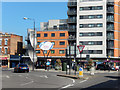
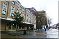
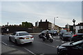
Photos of E15 1HP


Area Information
E15 1HP is a compact residential postcode in England, covering just 3,002 square metres and home to 2,269 residents. Its population density of 755,871 people per square kilometre reflects its small, tightly packed nature, typical of urban clusters. This area is defined by its proximity to key transport hubs and retail centres, offering a blend of convenience and connectivity. Daily life here is shaped by its strategic location, with easy access to major stations like Stratford International and nearby amenities such as Morrisons and Tesco. The area’s compact size means residents are likely to know their neighbours, though the high density also underscores the need for efficient infrastructure. While it lacks large green spaces, its proximity to rivers and transport links provides a balance between urban living and accessibility. For those seeking a compact, well-connected environment with a focus on practicality, E15 1HP offers a distinct mix of residential and commuter-oriented living.
- Area Type
- Postcode
- Area Size
- 3002 m²
- Population
- 2269
- Population Density
- 14146 people/km²
The property market in E15 1HP is characterised by a low home ownership rate of 32%, indicating that the majority of properties are likely rented rather than owner-occupied. The area’s accommodation type is predominantly houses, which is unusual for a small postcode with such a high population density. This suggests a mix of single-family homes and possibly terraced properties, though the exact distribution is unclear. Given the area’s size and the prevalence of houses, it may be challenging to find a wide variety of property types. For buyers, the small footprint of E15 1HP means competition for available homes could be intense, particularly for those seeking larger properties. The low home ownership rate also implies that the rental market may be more active, potentially offering opportunities for investors but also highlighting the area’s reliance on private tenancy.
House Prices in E15 1HP
Showing 3 properties
| Address | Type | Beds | Baths | Last Sale Price | Last Sale Date | |
|---|---|---|---|---|---|---|
| 1 Park Avenue, Stratford, London, E15 1HP | undefined | - | - | - | - | |
| 91 The Grove, Stratford, London, E15 1HP | undefined | - | - | - | - | |
| Stratford Advice Arcade, 107-109 The Grove, Stratford, London, E15 1HP | office_workshop | - | - | - | - |
Energy Efficiency in E15 1HP
E15 1HP’s proximity to retail hubs like Morrisons Stratford, Iceland Stratford 2, and Tesco Leytonstone ensures residents have access to essential shopping and dining options. The area’s transport links also grant easy access to larger leisure and cultural venues, though specific parks or recreational spaces are not listed in the data. The presence of multiple rail, metro, and ferry connections means residents can quickly reach destinations such as the City of London, Canary Wharf, or the Thames waterfront. The nearby Whipps Cross Bus Interchange and London City Airport further expand mobility options. While the area’s compact size may limit on-site amenities, its connectivity to surrounding regions compensates by offering a wide range of services, from retail to transport, creating a practical, urban lifestyle with a focus on accessibility over localised leisure.
Amenities
Schools
The nearest school to E15 1HP is Sarah Bonnell School, which operates as both a primary school and an academy with an Ofsted rating of ‘good’. This dual designation means it serves students from early years through to secondary education, offering a continuous educational pathway for families. The school’s ‘good’ rating suggests it meets acceptable standards in teaching, outcomes, and management, though it may not excel in all areas compared to top-rated institutions. For parents, the presence of a single school that covers multiple stages of education reduces the need to navigate multiple institutions, simplifying family planning. However, the limited number of schools in the area may restrict choice, particularly for families seeking alternative educational approaches or specialist provision.
| Rank | School | Type | Entry gender | Ages |
|---|
Explore more schools in this area
Go to Schools tabDemographics
The community in E15 1HP is predominantly middle-aged, with a median age of 47 and the majority of residents falling within the 30-64 age range. Home ownership here is relatively low, with only 32% of properties owned by their occupants, suggesting a significant proportion of the housing stock is rented. The area is composed mainly of houses, though the exact mix of household types is not specified. The predominant ethnic group is White, reflecting broader demographic trends in the region. While no data on deprivation is provided, the low home ownership rate may indicate a reliance on rental markets, which could influence affordability and stability for residents. The age profile suggests a mature population, potentially with established careers and family structures, though the area’s compact size may limit opportunities for younger families seeking larger homes or schools.
Household Size
Accommodation Type
Tenure
Ethnic Group
Religion
Household Composition
Age
Household Deprivation
NS-SEC
Explore more demographic insights in this area
Go to Demographics tabPlanning
Planning Constraints
- Flood RiskPremium
- Ramsar Wetland SitesPremium
- Area of Outstanding Natural BeautyPremium
- Protected Nature ReservePremium
- Protected WoodlandPremium