Area Overview for E14 3QR
Photos of E14 3QR
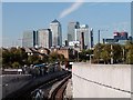

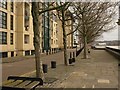
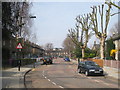
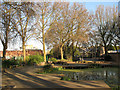
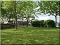

100 photos from this area
Area Information
Key information about the E14 3QR including its size, population, and administrative classification.
- Area Type
- Postcode
- Area Size
- 8209 m²
- Population
- 2514
- Population Density
- 18126 people/km²
House Prices in E14 3QR
40
Properties
£305,750
Average Sold Price
£72,000
Lowest Price
£1,195,000
Highest Price
Showing 40 properties
| Address | Type | Beds | Baths | Last Sale Price | Last Sale Date | |
|---|---|---|---|---|---|---|
| 43 Cahir Street, London, E14 3QR | Terraced | 2 | 1 | £491,000 | Sep 2024 | |
| 16 Cahir Street, London, E14 3QR | Terraced | 5 | 4 | £580,000 | May 2023 | |
| 55 Cahir Street, London, E14 3QR | Terraced | 2 | 1 | £1,195,000 | Jun 2021 | |
| 44 Cahir Street, London, E14 3QR | house | - | - | £532,500 | Apr 2021 | |
| 34 Cahir Street, London, E14 3QR | Terraced | 2 | 1 | £490,000 | Jul 2017 | |
| 32 Cahir Street, London, E14 3QR | house | 2 | - | £427,500 | May 2015 | |
| 51 Cahir Street, London, E14 3QR | Terraced | 2 | - | £472,000 | Jan 2015 | |
| 48 Cahir Street, London, E14 3QR | house | - | - | £385,000 | Oct 2013 | |
| 14 Cahir Street, London, E14 3QR | Terraced | 5 | 4 | £390,000 | Aug 2013 | |
| 42 Cahir Street, London, E14 3QR | house | 2 | - | £330,000 | Dec 2011 |
Page 1 of 4
Energy Efficiency in E14 3QR
Amenities
Schools
| Rank | School | Type | Entry gender | Ages |
|---|
Explore more schools in this area
Go to Schools tabDemographics
Household Size
Family (3-5 people)
most common
Accommodation Type
Flats
most common
Tenure
36
majority
Ethnic Group
White
most common
Religion
N/A
most common
Household Composition
N/A
most common
Age
47
median
Adults (30-64 years)
most common
Household Deprivation
N/A
with no deprivation
NS-SEC
39
in Lower managerial occupations
Explore more demographic insights in this area
Go to Demographics tabPlanning
Planning Constraints
- Flood RiskPremium
- Ramsar Wetland SitesPremium
- Area of Outstanding Natural BeautyPremium
- Protected Nature ReservePremium
- Protected WoodlandPremium