Area Overview for E13 9NJ
Photos of E13 9NJ


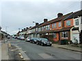
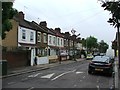
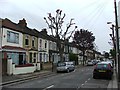
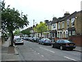
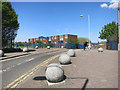
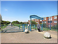
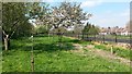
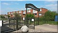
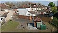
55 photos from this area
Area Information
Key information about the E13 9NJ including its size, population, and administrative classification.
- Area Type
- Postcode
- Area Size
- 2.7 hectares
- Population
- 2034
- Population Density
- 21871 people/km²
House Prices in E13 9NJ
65
Properties
£260,811
Average Sold Price
£54,995
Lowest Price
£560,000
Highest Price
Showing 65 properties
| Address | Type | Beds | Baths | Last Sale Price | Last Sale Date | |
|---|---|---|---|---|---|---|
| 118 Humberstone Road, Plaistow, London, E13 9NJ | Terraced | 5 | 2 | £560,000 | Jul 2025 | |
| 90 Humberstone Road, Plaistow, London, E13 9NJ | Terraced | 2 | 1 | £380,000 | Mar 2025 | |
| 60 Humberstone Road, Plaistow, London, E13 9NJ | Terraced | 2 | 1 | £442,000 | Oct 2024 | |
| 42 Humberstone Road, Plaistow, London, E13 9NJ | Terraced | 2 | 1 | £410,000 | Jun 2024 | |
| 62 Humberstone Road, Plaistow, London, E13 9NJ | Terraced | 2 | 1 | £370,000 | May 2024 | |
| 86 Humberstone Road, Plaistow, London, E13 9NJ | Terraced | 2 | - | £333,000 | Mar 2024 | |
| 80 Humberstone Road, Plaistow, London, E13 9NJ | Terraced | 2 | 1 | £370,000 | May 2023 | |
| 88 Humberstone Road, Plaistow, London, E13 9NJ | Terraced | 2 | 1 | £400,000 | May 2023 | |
| 104 Humberstone Road, Plaistow, London, E13 9NJ | Terraced | 2 | 1 | £500,000 | Apr 2022 | |
| 84 Humberstone Road, Plaistow, London, E13 9NJ | house | - | - | £370,500 | Apr 2021 |
Page 1 of 7
Energy Efficiency in E13 9NJ
Amenities
Schools
| Rank | School | Type | Entry gender | Ages |
|---|
Explore more schools in this area
Go to Schools tabDemographics
Household Size
Family (3-5 people)
most common
Accommodation Type
Houses
most common
Tenure
49
majority
Ethnic Group
White
most common
Religion
N/A
most common
Household Composition
N/A
most common
Age
47
median
Adults (30-64 years)
most common
Household Deprivation
N/A
with no deprivation
NS-SEC
28
in Lower managerial occupations
Explore more demographic insights in this area
Go to Demographics tabPlanning
Planning Constraints
- Flood RiskPremium
- Ramsar Wetland SitesPremium
- Area of Outstanding Natural BeautyPremium
- Protected Nature ReservePremium
- Protected WoodlandPremium