Area Overview for E13 8RF
Photos of E13 8RF
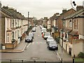
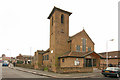
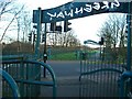
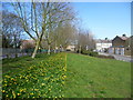
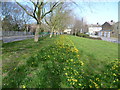
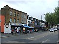
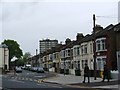
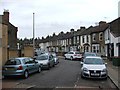
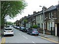
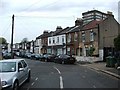
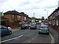
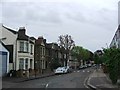
80 photos from this area
Area Information
Key information about the E13 8RF including its size, population, and administrative classification.
- Area Type
- Postcode
- Area Size
- 8918 m²
- Population
- 2187
- Population Density
- 18347 people/km²
House Prices in E13 8RF
56
Properties
£233,064
Average Sold Price
£35,000
Lowest Price
£455,000
Highest Price
Showing 56 properties
| Address | Type | Beds | Baths | Last Sale Price | Last Sale Date | |
|---|---|---|---|---|---|---|
| 39 Khartoum Road, Plaistow, London, E13 8RF | Terraced | 3 | 2 | £455,000 | Jul 2024 | |
| 67 Khartoum Road, Plaistow, London, E13 8RF | Terraced | 3 | 1 | £400,000 | Nov 2023 | |
| 69 Khartoum Road, Plaistow, London, E13 8RF | Terraced | 2 | 1 | £427,000 | Oct 2023 | |
| 75 Khartoum Road, Plaistow, London, E13 8RF | Terraced | 3 | 1 | £332,000 | Apr 2023 | |
| 35 Khartoum Road, Plaistow, London, E13 8RF | Terraced | 5 | - | £420,000 | Apr 2021 | |
| 2A Khartoum Road, Plaistow, London, E13 8RF | Flat | 2 | 1 | £255,000 | Apr 2021 | |
| 63 Khartoum Road, Plaistow, London, E13 8RF | Terraced | 3 | 1 | £360,000 | Jun 2019 | |
| 21 Khartoum Road, Plaistow, London, E13 8RF | house | 3 | 2 | £435,000 | Sep 2017 | |
| 25 Khartoum Road, Plaistow, London, E13 8RF | Terraced | 3 | 1 | £407,000 | Aug 2017 | |
| 65 Khartoum Road, Plaistow, London, E13 8RF | Terraced | 4 | 2 | £377,500 | Aug 2016 |
Page 1 of 6
Energy Efficiency in E13 8RF
Amenities
Schools
| Rank | School | Type | Entry gender | Ages |
|---|
Explore more schools in this area
Go to Schools tabDemographics
Household Size
Family (3-5 people)
most common
Accommodation Type
Houses
most common
Tenure
38
majority
Ethnic Group
White
most common
Religion
N/A
most common
Household Composition
N/A
most common
Age
47
median
Adults (30-64 years)
most common
Household Deprivation
N/A
with no deprivation
NS-SEC
19
in Lower managerial occupations
Explore more demographic insights in this area
Go to Demographics tabPlanning
Planning Constraints
- Flood RiskPremium
- Ramsar Wetland SitesPremium
- Area of Outstanding Natural BeautyPremium
- Protected Nature ReservePremium
- Protected WoodlandPremium