Area Overview for E13 8PR
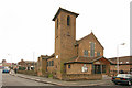
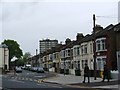
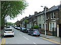
Photos of E13 8PR


Area Information
E13 8PR is a small, residential postcode area in east London with a population of 2373. It is a compact cluster of flats, reflecting a community that leans heavily on rental housing. The area’s character is shaped by its proximity to major transport hubs, including metro, rail, and ferry services, which connect residents to nearby boroughs and the city centre. Daily life here is defined by convenience: shops like Iceland and Tesco are within walking distance, and multiple stations provide access to London City Airport and key employment zones. The median age of 47 suggests a mature population, with many residents in the 30-64 age range. While the area lacks natural landscapes or protected sites, its practicality and connectivity make it appealing for those prioritising accessibility over scenic surroundings. However, the high crime risk score of 32/100 underscores the need for caution, particularly for families or individuals seeking a secure environment. For buyers, E13 8PR offers a snapshot of urban living in a densely networked part of London, though its small size means limited housing options.
- Area Type
- Postcode
- Area Size
- Not available
- Population
- 2373
- Population Density
- 13926 people/km²
The property market in E13 8PR is characterised by a high proportion of rental properties, with only 24% of homes owned by residents. This suggests a market dominated by landlords and tenants, rather than owner-occupiers. The accommodation type is exclusively flats, which are typically smaller and suited to single-person or couples’ living. The area’s small size means housing stock is limited, and buyers seeking owner-occupied properties may find few options. For those considering investment, the rental market could offer steady returns, though the high crime risk score of 32/100 may deter some buyers. The proximity to transport links, including metro, rail, and ferry services, enhances the area’s appeal for commuters, but the lack of protected natural sites or amenities like parks means residents must look beyond the postcode for leisure. Buyers should weigh the practical advantages of connectivity against the challenges of a rental-heavy market and potential security concerns.
House Prices in E13 8PR
No properties found in this postcode.
Energy Efficiency in E13 8PR
Life in E13 8PR is shaped by its proximity to retail, dining, and transport hubs. Nearby shops include Iceland outlets at 480-482 and Tesco Green Gate, offering everyday essentials. The area’s transport infrastructure is extensive, with metro, rail, ferry, and bus services providing access to London’s major districts. While there are no parks or leisure facilities explicitly listed in the data, the presence of multiple stations and the nearby Royal Wharf Pier suggest opportunities for recreation beyond the postcode. The variety of transport options allows residents to commute efficiently, while retail choices cater to daily needs. The character of the area is pragmatic, with amenities focused on functionality rather than leisure. For those valuing convenience and connectivity, E13 8PR offers a compact, accessible environment, though it may lack the green spaces or cultural venues found in more sprawling neighbourhoods.
Amenities
Schools
The only school listed near E13 8PR is Promised Land Academy, an independent institution. Independent schools typically charge fees and operate outside the state education system, offering specialised curricula or smaller class sizes. The absence of other schools in the data suggests limited options for families seeking state-funded education. For those prioritising independent schooling, Promised Land Academy may be a viable choice, but its specific Ofsted rating is not provided. The mix of school types in the area is therefore narrow, with no mention of state primary or secondary schools. This could be a drawback for families requiring diverse educational choices or those seeking lower-cost alternatives. Residents should investigate further to confirm whether additional schools exist beyond the listed options.
| Rank | School | Type | Entry gender | Ages |
|---|
Explore more schools in this area
Go to Schools tabDemographics
The population of E13 8PR is predominantly adults aged 30-64, with a median age of 47. Home ownership is low, at 24%, indicating that the majority of residents are renters. The accommodation type is primarily flats, reflecting a housing stock suited to smaller households or those prioritising rental flexibility. The predominant ethnic group is White, though specific diversity metrics are not detailed in the data. The age profile suggests a community with established careers and families, though the absence of data on deprivation levels means it is unclear how this impacts quality of life. The low home ownership rate may indicate a transient population or a focus on rental affordability, but it also limits the potential for long-term investment in property. The area’s demographics align with a functional, urbanised environment where convenience and transport access are prioritised over traditional family-oriented housing features.
Household Size
Accommodation Type
Tenure
Ethnic Group
Religion
Household Composition
Age
Household Deprivation
NS-SEC
Explore more demographic insights in this area
Go to Demographics tabPlanning
Planning Constraints
- Flood RiskPremium
- Ramsar Wetland SitesPremium
- Area of Outstanding Natural BeautyPremium
- Protected Nature ReservePremium
- Protected WoodlandPremium