Area Overview for E13 8PH
Photos of E13 8PH
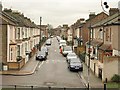
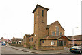
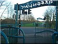
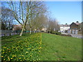
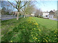
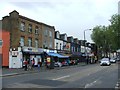
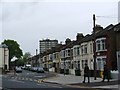
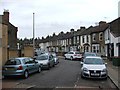
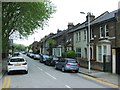
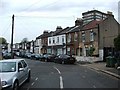
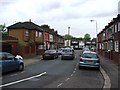
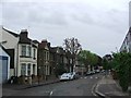
80 photos from this area
Area Information
Key information about the E13 8PH including its size, population, and administrative classification.
- Area Type
- Postcode
- Area Size
- 3554 m²
- Population
- 2290
- Population Density
- 10348 people/km²
House Prices in E13 8PH
22
Properties
£212,408
Average Sold Price
£42,000
Lowest Price
£550,000
Highest Price
Showing 22 properties
| Address | Type | Beds | Baths | Last Sale Price | Last Sale Date | |
|---|---|---|---|---|---|---|
| 1 Holborn Road, Plaistow, London, E13 8PH | house | 3 | - | £550,000 | Dec 2021 | |
| 33 Holborn Road, Plaistow, London, E13 8PH | Semi-detached | 2 | 1 | £381,000 | Dec 2020 | |
| 31 Holborn Road, Plaistow, London, E13 8PH | Terraced | 2 | - | £330,400 | Nov 2017 | |
| 25 Holborn Road, Plaistow, London, E13 8PH | house | 3 | - | £260,000 | Dec 2014 | |
| 19 Holborn Road, Plaistow, London, E13 8PH | Terraced | - | - | £198,000 | Jan 2009 | |
| 29 Holborn Road, Plaistow, London, E13 8PH | house | 2 | - | £185,000 | Nov 2003 | |
| 15 Holborn Road, Plaistow, London, E13 8PH | Terraced | - | - | £149,995 | Jul 2003 | |
| 35 Holborn Road, Plaistow, London, E13 8PH | house | - | - | £165,000 | Jul 2003 | |
| 3 Holborn Road, Plaistow, London, E13 8PH | house | 4 | 2 | £160,000 | Apr 2003 | |
| 11 Holborn Road, Plaistow, London, E13 8PH | Semi-detached | 2 | 1 | £74,500 | Oct 1999 |
Page 1 of 3
Energy Efficiency in E13 8PH
Amenities
Schools
| Rank | School | Type | Entry gender | Ages |
|---|
Explore more schools in this area
Go to Schools tabDemographics
Household Size
Family (3-5 people)
most common
Accommodation Type
Houses
most common
Tenure
33
majority
Ethnic Group
White
most common
Religion
N/A
most common
Household Composition
N/A
most common
Age
47
median
Adults (30-64 years)
most common
Household Deprivation
N/A
with no deprivation
NS-SEC
19
in Lower managerial occupations
Explore more demographic insights in this area
Go to Demographics tabPlanning
Planning Constraints
- Flood RiskPremium
- Ramsar Wetland SitesPremium
- Area of Outstanding Natural BeautyPremium
- Protected Nature ReservePremium
- Protected WoodlandPremium