Area Overview for E13 8ND
Photos of E13 8ND
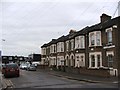
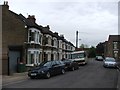
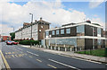
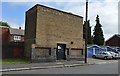
81 photos from this area
Area Information
Key information about the E13 8ND including its size, population, and administrative classification.
- Area Type
- Postcode
- Area Size
- 5598 m²
- Population
- 2290
- Population Density
- 10348 people/km²
House Prices in E13 8ND
62
Properties
£259,465
Average Sold Price
£74,995
Lowest Price
£650,000
Highest Price
Showing 62 properties
| Address | Type | Beds | Baths | Last Sale Price | Last Sale Date | |
|---|---|---|---|---|---|---|
| 75 Chadwin Road, Plaistow, London, E13 8ND | Terraced | 3 | 1 | £360,000 | Mar 2025 | |
| 1B Chadwin Road, Plaistow, London, E13 8ND | Terraced | 3 | 1 | £400,000 | Feb 2025 | |
| 43 Chadwin Road, Plaistow, London, E13 8ND | Terraced | 3 | 1 | £317,500 | Dec 2023 | |
| 1 Chadwin Road, Plaistow, London, E13 8ND | Terraced | 3 | 1 | £470,000 | Oct 2023 | |
| 21 Chadwin Road, Plaistow, London, E13 8ND | Terraced | 4 | - | £422,500 | Dec 2021 | |
| 37 Chadwin Road, Plaistow, London, E13 8ND | house | - | - | £325,000 | Dec 2020 | |
| 65 Chadwin Road, Plaistow, London, E13 8ND | Terraced | 2 | 1 | £333,000 | Apr 2020 | |
| 29A Chadwin Road, Plaistow, London, E13 8ND | Flat | - | - | £165,000 | Mar 2020 | |
| 63 Chadwin Road, Plaistow, London, E13 8ND | Terraced | 2 | 1 | £375,000 | Aug 2019 | |
| 9 Chadwin Road, Plaistow, London, E13 8ND | Terraced | 2 | 1 | £335,000 | Oct 2018 |
Page 1 of 7
Energy Efficiency in E13 8ND
Amenities
Schools
| Rank | School | Type | Entry gender | Ages |
|---|
Explore more schools in this area
Go to Schools tabDemographics
Household Size
Family (3-5 people)
most common
Accommodation Type
Houses
most common
Tenure
33
majority
Ethnic Group
White
most common
Religion
N/A
most common
Household Composition
N/A
most common
Age
47
median
Adults (30-64 years)
most common
Household Deprivation
N/A
with no deprivation
NS-SEC
19
in Lower managerial occupations
Explore more demographic insights in this area
Go to Demographics tabPlanning
Planning Constraints
- Flood RiskPremium
- Ramsar Wetland SitesPremium
- Area of Outstanding Natural BeautyPremium
- Protected Nature ReservePremium
- Protected WoodlandPremium