Area Overview for E13 8HL
Photos of E13 8HL
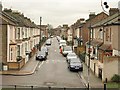
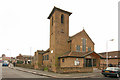

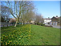
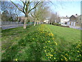
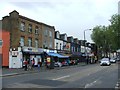
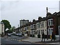
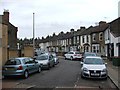
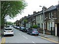
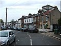
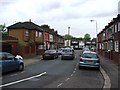
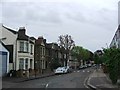
80 photos from this area
Area Information
Key information about the E13 8HL including its size, population, and administrative classification.
- Area Type
- Postcode
- Area Size
- 1.0 hectares
- Population
- 2261
- Population Density
- 15911 people/km²
House Prices in E13 8HL
100
Properties
£242,182
Average Sold Price
£65,000
Lowest Price
£535,000
Highest Price
Showing 100 properties
| Address | Type | Beds | Baths | Last Sale Price | Last Sale Date | |
|---|---|---|---|---|---|---|
| 302A Barking Road, Plaistow, London, E13 8HL | Flat | - | - | £535,000 | Dec 2022 | |
| 334B Barking Road, Plaistow, London, E13 8HL | Flat | 1 | 1 | £230,000 | Sep 2016 | |
| 330C Barking Road, Plaistow, London, E13 8HL | Detached | 1 | 1 | £160,000 | Jun 2016 | |
| 332B Barking Road, Plaistow, London, E13 8HL | Maisonette | - | - | £150,000 | Jan 2016 | |
| 356A Barking Road, Plaistow, London, E13 8HL | Flat | - | 1 | £360,000 | Aug 2015 | |
| 338 Barking Road, Plaistow, London, E13 8HL | Flat | 1 | 1 | £250,000 | Jul 2014 | |
| 304A Barking Road, Plaistow, London, E13 8HL | Retail | - | - | £250,000 | Jun 2014 | |
| First And Second Floor, 364 Barking Road, Plaistow, London, E13 8HL | Flat | - | - | £149,999 | May 2012 | |
| 328A Barking Road, Plaistow, London, E13 8HL | Flat | - | - | £170,000 | Jul 2006 | |
| 324A Barking Road, Plaistow, London, E13 8HL | Flat | 2 | 1 | £344,000 | Jul 2006 |
Page 1 of 10
Energy Efficiency in E13 8HL
Amenities
Schools
| Rank | School | Type | Entry gender | Ages |
|---|
Explore more schools in this area
Go to Schools tabDemographics
Household Size
Family (3-5 people)
most common
Accommodation Type
Houses
most common
Tenure
32
majority
Ethnic Group
White
most common
Religion
N/A
most common
Household Composition
N/A
most common
Age
47
median
Adults (30-64 years)
most common
Household Deprivation
N/A
with no deprivation
NS-SEC
20
in Lower managerial occupations
Explore more demographic insights in this area
Go to Demographics tabPlanning
Planning Constraints
- Flood RiskPremium
- Ramsar Wetland SitesPremium
- Area of Outstanding Natural BeautyPremium
- Protected Nature ReservePremium
- Protected WoodlandPremium