Area Overview for E13 8EQ
Photos of E13 8EQ
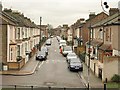
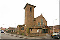
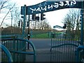
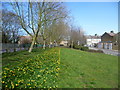
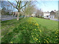
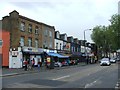
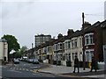
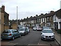
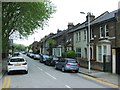
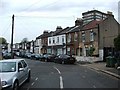
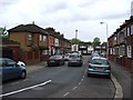
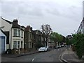
80 photos from this area
Area Information
Key information about the E13 8EQ including its size, population, and administrative classification.
- Area Type
- Postcode
- Area Size
- 9878 m²
- Population
- 2355
- Population Density
- 14867 people/km²
House Prices in E13 8EQ
100
Properties
£444,166
Average Sold Price
£60,000
Lowest Price
£1,820,000
Highest Price
Showing 100 properties
| Address | Type | Beds | Baths | Last Sale Price | Last Sale Date | |
|---|---|---|---|---|---|---|
| 305 Barking Road, Plaistow, London, E13 8EQ | Flat | - | - | £1,820,000 | Mar 2020 | |
| 249A Barking Road, Plaistow, London, E13 8EQ | Flat | - | - | £312,500 | Oct 2007 | |
| 259 Barking Road, Plaistow, London, E13 8EQ | Flat | - | - | £130,000 | Dec 2005 | |
| 247A Barking Road, Plaistow, London, E13 8EQ | Flat | - | - | £262,500 | Mar 2005 | |
| 259A Barking Road, Plaistow, London, E13 8EQ | Flat | 4 | 2 | £79,995 | Nov 2001 | |
| 281C Barking Road, Plaistow, London, E13 8EQ | Terraced | 4 | 1 | £60,000 | Mar 2000 | |
| Studio Flat First Floor Rear, 255 Barking Road, Plaistow, London, E13 8EQ | Terraced | 7 | 4 | - | - | |
| 243A Barking Road, Plaistow, London, E13 8EQ | Flat | 2 | 1 | - | - | |
| Top Flat, 251 Barking Road, Plaistow, London, E13 8EQ | Retail | - | 1 | - | - | |
| First Floor And Second Floor, 251 Barking Road, Plaistow, London, E13 8EQ | Retail | - | 1 | - | - |
Page 1 of 10
Energy Efficiency in E13 8EQ
Amenities
Schools
| Rank | School | Type | Entry gender | Ages |
|---|
Explore more schools in this area
Go to Schools tabDemographics
Household Size
Family (3-5 people)
most common
Accommodation Type
Flats
most common
Tenure
31
majority
Ethnic Group
White
most common
Religion
N/A
most common
Household Composition
N/A
most common
Age
47
median
Adults (30-64 years)
most common
Household Deprivation
N/A
with no deprivation
NS-SEC
19
in Lower managerial occupations
Explore more demographic insights in this area
Go to Demographics tabPlanning
Planning Constraints
- Flood RiskPremium
- Ramsar Wetland SitesPremium
- Area of Outstanding Natural BeautyPremium
- Protected Nature ReservePremium
- Protected WoodlandPremium