Area Overview for E13 8DX
Photos of E13 8DX
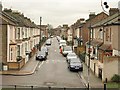
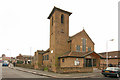
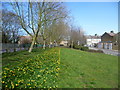
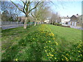
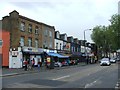
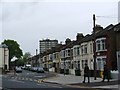
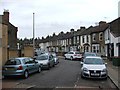
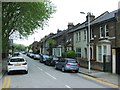
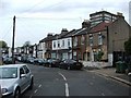
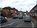
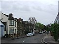
80 photos from this area
Area Information
Key information about the E13 8DX including its size, population, and administrative classification.
- Area Type
- Postcode
- Area Size
- 3626 m²
- Population
- 2355
- Population Density
- 14867 people/km²
House Prices in E13 8DX
43
Properties
£157,950
Average Sold Price
£22,000
Lowest Price
£290,000
Highest Price
Showing 43 properties
| Address | Type | Beds | Baths | Last Sale Price | Last Sale Date | |
|---|---|---|---|---|---|---|
| 167 King Street, Plaistow, London, E13 8DX | Flat | - | - | £245,000 | Jan 2022 | |
| 169 King Street, Plaistow, London, E13 8DX | Flat | - | - | £290,000 | Nov 2017 | |
| 115 King Street, Plaistow, London, E13 8DX | Flat | - | - | £275,000 | Jun 2017 | |
| 145 King Street, Plaistow, London, E13 8DX | Flat | 2 | 1 | £270,000 | Jan 2017 | |
| 137 King Street, Plaistow, London, E13 8DX | Flat | - | - | £194,000 | Aug 2007 | |
| 117 King Street, Plaistow, London, E13 8DX | Flat | - | - | £164,950 | Apr 2007 | |
| 125 King Street, Plaistow, London, E13 8DX | Flat | - | - | £117,000 | Nov 2002 | |
| 157 King Street, Plaistow, London, E13 8DX | Flat | - | - | £72,000 | Nov 2000 | |
| 163 King Street, Plaistow, London, E13 8DX | Flat | - | - | £47,500 | Sep 1998 | |
| 173 King Street, Plaistow, London, E13 8DX | Flat | - | - | £39,995 | Oct 1997 |
Page 1 of 5
Energy Efficiency in E13 8DX
Amenities
Schools
| Rank | School | Type | Entry gender | Ages |
|---|
Explore more schools in this area
Go to Schools tabDemographics
Household Size
Family (3-5 people)
most common
Accommodation Type
Flats
most common
Tenure
31
majority
Ethnic Group
White
most common
Religion
N/A
most common
Household Composition
N/A
most common
Age
47
median
Adults (30-64 years)
most common
Household Deprivation
N/A
with no deprivation
NS-SEC
19
in Lower managerial occupations
Explore more demographic insights in this area
Go to Demographics tabPlanning
Planning Constraints
- Flood RiskPremium
- Ramsar Wetland SitesPremium
- Area of Outstanding Natural BeautyPremium
- Protected Nature ReservePremium
- Protected WoodlandPremium