Area Overview for E13 8DR
Photos of E13 8DR
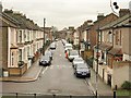
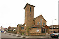

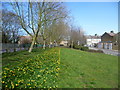
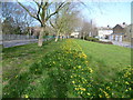
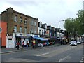
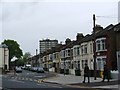
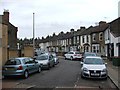
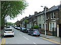
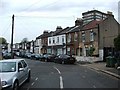
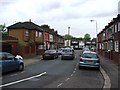
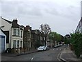
80 photos from this area
Area Information
Key information about the E13 8DR including its size, population, and administrative classification.
- Area Type
- Postcode
- Area Size
- 5951 m²
- Population
- 2373
- Population Density
- 13926 people/km²
House Prices in E13 8DR
24
Properties
£174,479
Average Sold Price
£45,000
Lowest Price
£375,000
Highest Price
Showing 24 properties
| Address | Type | Beds | Baths | Last Sale Price | Last Sale Date | |
|---|---|---|---|---|---|---|
| 11 Doherty Road, Plaistow, London, E13 8DR | house | - | - | £375,000 | Apr 2024 | |
| 45 Doherty Road, Plaistow, London, E13 8DR | Terraced | 3 | 1 | £185,000 | Jan 2015 | |
| 7 Doherty Road, Plaistow, London, E13 8DR | house | 2 | - | £208,500 | Jun 2013 | |
| 41 Doherty Road, Plaistow, London, E13 8DR | house | 3 | - | £250,000 | Dec 2007 | |
| 43 Doherty Road, Plaistow, London, E13 8DR | house | - | - | £200,000 | Jul 2005 | |
| 5 Doherty Road, Plaistow, London, E13 8DR | Terraced | - | - | £116,000 | Mar 2003 | |
| 39 Doherty Road, Plaistow, London, E13 8DR | house | - | - | £155,000 | Oct 2002 | |
| 47 Doherty Road, Plaistow, London, E13 8DR | house | - | - | £135,000 | Jun 2002 | |
| 33 Doherty Road, Plaistow, London, E13 8DR | house | - | - | £268,000 | Sep 2001 | |
| 3 Doherty Road, Plaistow, London, E13 8DR | Terraced | 3 | 1 | £99,000 | Dec 2000 |
Page 1 of 3
Energy Efficiency in E13 8DR
Amenities
Schools
| Rank | School | Type | Entry gender | Ages |
|---|
Explore more schools in this area
Go to Schools tabDemographics
Household Size
Family (3-5 people)
most common
Accommodation Type
Flats
most common
Tenure
24
majority
Ethnic Group
White
most common
Religion
N/A
most common
Household Composition
N/A
most common
Age
47
median
Adults (30-64 years)
most common
Household Deprivation
N/A
with no deprivation
NS-SEC
17
in Lower managerial occupations
Explore more demographic insights in this area
Go to Demographics tabPlanning
Planning Constraints
- Flood RiskPremium
- Ramsar Wetland SitesPremium
- Area of Outstanding Natural BeautyPremium
- Protected Nature ReservePremium
- Protected WoodlandPremium