Area Overview for E13 0RP
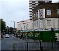
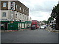
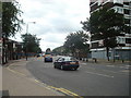
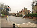
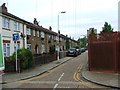
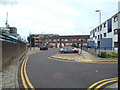
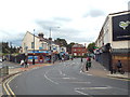
Photos of E13 0RP


Area Information
E13 0RP is a small, tightly knit residential area in east London with a population of 2586. It is a modest cluster of homes, primarily occupied by adults aged 30–64, reflecting a community that is neither young nor elderly. The area’s character is defined by its proximity to transport hubs, including Upton Park and Plaistow metro stations, which provide easy access to central London. Daily life here is shaped by a balance of practicality and convenience, with shops like Tesco Upton Park and Lidl London within walking distance. The area’s safety is a notable feature, with a crime risk score of 90, indicating below-average crime rates. While it lacks natural landscapes or protected sites, its low flood risk and proximity to London City Airport make it an appealing choice for those prioritising security and connectivity. Living in E13 0RP means navigating a compact, functional environment where essential services are close, and the community’s demographic stability offers a predictable, grounded lifestyle.
- Area Type
- Postcode
- Area Size
- Not available
- Population
- 2586
- Population Density
- 23552 people/km²
The property market in E13 0RP is modest, with 47% of homes owned by residents and the remainder likely rented. The accommodation type is primarily houses, which are more common than flats in this area. This suggests a community skewed towards family households, where space and privacy are prioritised. The low home ownership rate may indicate a rental market dominated by private landlords or social housing providers. For buyers, this means limited availability of owner-occupied properties, with competition likely among those seeking stable, family-friendly homes. The small size of the area and its immediate surroundings further restrict options, making it a niche market for those requiring specific criteria like proximity to transport or schools. Potential buyers should consider the balance between affordability and the need for long-term stability in a market where ownership is not the norm.
House Prices in E13 0RP
No properties found in this postcode.
Energy Efficiency in E13 0RP
Daily life in E13 0RP is shaped by its proximity to a range of amenities. Retail options include major stores like Tesco Upton Park, Iceland Upton, and Lidl London, ensuring access to groceries and household essentials. The area’s transport network is its strongest feature, with metro, rail, and ferry connections providing flexibility for travel. Stations such as Forest Gate and Wanstead Park offer links to broader London, while London City Airport is within reach for those needing air travel. For leisure, the absence of parks or green spaces is notable, but the area’s compact size means residents can reach nearby recreational areas via public transport. The mix of retail, transport, and connectivity options creates a practical, no-frills lifestyle focused on convenience and accessibility.
Amenities
Schools
The nearest school to E13 0RP is Upton Cross Primary School, which serves the local community with a primary education offering. Its Ofsted rating of ‘good’ indicates a satisfactory standard of teaching and facilities, though it does not feature higher education options. The absence of secondary schools or specialist institutions means families may need to look beyond the immediate area for comprehensive education. For those prioritising primary schooling, Upton Cross Primary provides a practical solution, but parents seeking a full range of educational stages will need to factor in travel time to nearby secondary schools. The single school listed reflects the area’s limited educational infrastructure, which may be a consideration for growing families.
| Rank | School | Type | Entry gender | Ages |
|---|
Explore more schools in this area
Go to Schools tabDemographics
The population of E13 0RP is predominantly adults aged 30–64, with a median age of 47. This suggests a community of established professionals and families, rather than students or retirees. Home ownership stands at 47%, meaning nearly half of residents rent, which may indicate a mix of long-term residents and those in transient housing. The area is characterised by houses rather than flats, aligning with a preference for family-oriented living spaces. The predominant ethnic group is Asian, reflecting a cultural diversity that influences local traditions and community dynamics. While no specific deprivation data is provided, the low crime risk and functional amenities suggest a stable quality of life. The demographic profile indicates a mature, settled population with established routines and a focus on practical living over luxury.
Household Size
Accommodation Type
Tenure
Ethnic Group
Religion
Household Composition
Age
Household Deprivation
NS-SEC
Explore more demographic insights in this area
Go to Demographics tabPlanning
Planning Constraints
- Flood RiskPremium
- Ramsar Wetland SitesPremium
- Area of Outstanding Natural BeautyPremium
- Protected Nature ReservePremium
- Protected WoodlandPremium