Area Overview for E13 0RF
Photos of E13 0RF
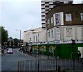
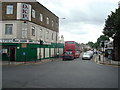
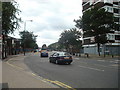
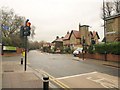
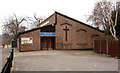
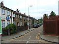
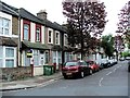
70 photos from this area
Area Information
Key information about the E13 0RF including its size, population, and administrative classification.
- Area Type
- Postcode
- Area Size
- 6538 m²
- Population
- 2586
- Population Density
- 23552 people/km²
House Prices in E13 0RF
51
Properties
£193,700
Average Sold Price
£40,000
Lowest Price
£388,000
Highest Price
Showing 51 properties
| Address | Type | Beds | Baths | Last Sale Price | Last Sale Date | |
|---|---|---|---|---|---|---|
| 16 Gwendoline Avenue, Upton Park, London, E13 0RF | Flat | 2 | 1 | £370,000 | Jan 2023 | |
| 10 Gwendoline Avenue, Upton Park, London, E13 0RF | Maisonette | - | - | £388,000 | Dec 2020 | |
| 8 Gwendoline Avenue, Upton Park, London, E13 0RF | Flat | - | - | £72,000 | Jul 2018 | |
| 14 Gwendoline Avenue, Upton Park, London, E13 0RF | Flat | 2 | 1 | £40,000 | Aug 2017 | |
| 12 Gwendoline Avenue, Upton Park, London, E13 0RF | Flat | 2 | - | £345,000 | Aug 2015 | |
| 32 Gwendoline Avenue, Upton Park, London, E13 0RF | house | - | - | £250,000 | Jul 2010 | |
| 36 Gwendoline Avenue, Upton Park, London, E13 0RF | Terraced | - | - | £250,000 | Jan 2008 | |
| 1 Gwendoline Avenue, Upton Park, London, E13 0RF | Terraced | 1 | 2 | £295,000 | Feb 2007 | |
| 22 Gwendoline Avenue, Upton Park, London, E13 0RF | Detached | 5 | - | £260,000 | Nov 2005 | |
| 18 Gwendoline Avenue, Upton Park, London, E13 0RF | Flat | - | - | £137,000 | Jun 2004 |
Page 1 of 6
Energy Efficiency in E13 0RF
Amenities
Schools
| Rank | School | Type | Entry gender | Ages |
|---|
Explore more schools in this area
Go to Schools tabDemographics
Household Size
Family (3-5 people)
most common
Accommodation Type
Houses
most common
Tenure
47
majority
Ethnic Group
asian_total
most common
Religion
N/A
most common
Household Composition
N/A
most common
Age
47
median
Adults (30-64 years)
most common
Household Deprivation
N/A
with no deprivation
NS-SEC
19
in Lower managerial occupations
Explore more demographic insights in this area
Go to Demographics tabPlanning
Planning Constraints
- Flood RiskPremium
- Ramsar Wetland SitesPremium
- Area of Outstanding Natural BeautyPremium
- Protected Nature ReservePremium
- Protected WoodlandPremium