Area Overview for E13 0QX
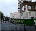
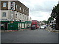
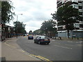
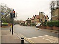
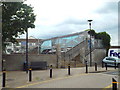
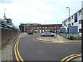
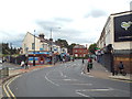
Photos of E13 0QX

Area Information
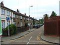
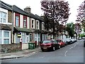
E13 0QX is a small residential cluster in east London with a population of 2,465. It sits within a compact area that balances suburban living with proximity to major transport routes. The community is defined by its mix of houses and practical amenities, making it a viable option for those seeking a quieter lifestyle without sacrificing connectivity. While the area is not expansive, it offers access to essential services and transport hubs within walking or short-vehicle distance. The median age of 47 suggests a mature population, with a significant proportion of residents in their 30s to 60s. This demographic may appeal to buyers looking for stable, long-term housing. The postcode’s location near Upton Park and surrounding stations positions it as a commuter-friendly zone, though its small size means the housing stock is limited. For those considering E13 0QX, the key factors are its practicality, the availability of nearby transport, and the presence of essential retail and leisure options within the immediate vicinity.
- Area Type
- Postcode
- Area Size
- Not available
- Population
- 2465
- Population Density
- 23521 people/km²
E13 0QX is a small area with a housing stock dominated by houses, which is unusual in densely populated parts of London. However, only 39% of properties are owner-occupied, indicating a rental market that likely serves both local residents and commuters. The limited size of the area means the number of available properties is constrained, which could make the market competitive for buyers. The predominance of houses suggests a focus on family-friendly or semi-detached living, though the low home ownership rate implies that many residents are tenants. For buyers, this means the area may not offer a wide selection of properties, and those seeking owner-occupied homes may need to look beyond the immediate postcode. The small scale of E13 0QX also means that property values and availability are closely tied to the broader east London market, particularly near transport links like Upton Park station.
House Prices in E13 0QX
No properties found in this postcode.
Energy Efficiency in E13 0QX
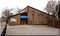
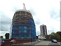
Living in E13 0QX offers access to a range of practical amenities within reach. The area includes five retail outlets, such as Tesco Upton Park, Iceland Upton, and Lidl London, providing essential shopping options. Nearby transport hubs like Upton Park metro station and Forest Gate rail station make commuting straightforward, while ferry piers at East India and North Greenwich offer alternative travel routes. The presence of multiple stations also means residents can easily access leisure and cultural venues in surrounding areas. Although the data does not specify parks or recreational spaces, the proximity to stations like Wanstead Park suggests nearby green spaces. The area’s character is defined by its convenience—supermarkets, transport, and airports are all within practical reach, supporting a lifestyle that balances daily needs with connectivity to the wider city.
Amenities
Schools
| Rank | School | Type | Entry gender | Ages |
|---|
Explore more schools in this area
Go to Schools tabDemographics
The population of E13 0QX is predominantly adults aged 30–64, with a median age of 47. This suggests a community of established professionals and families, though the 39% home ownership rate indicates a significant proportion of residents rent their homes. The accommodation type is primarily houses, which is uncommon in many urban areas, hinting at a more spread-out, suburban character. The predominant ethnic group is Asian, reflecting broader demographic trends in east London. While no specific deprivation data is provided, the age profile and home ownership rate suggest a mix of economic stability and rental dependency. The absence of detailed deprivation metrics means it is challenging to assess the area’s quality of life in terms of socioeconomic challenges, but the presence of houses and a mature population implies a focus on long-term residency over transient living.
Household Size
Accommodation Type
Tenure
Ethnic Group
Religion
Household Composition
Age
Household Deprivation
NS-SEC
Explore more demographic insights in this area
Go to Demographics tabPlanning
Planning Constraints
- Flood RiskPremium
- Ramsar Wetland SitesPremium
- Area of Outstanding Natural BeautyPremium
- Protected Nature ReservePremium
- Protected WoodlandPremium