Area Overview for E13 0PH
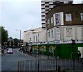
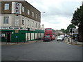
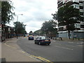
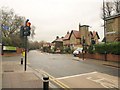
Photos of E13 0PH


Area Information
Living in E13 0PH means being part of a small, tightly knit residential cluster in east London. With a population of 1,629, the area is compact but well-served by transport and amenities. The community is predominantly adults aged 30–64, with a median age of 47, suggesting a stable, established demographic. Most homes are flats, reflecting a rental-heavy market, though 27% of residents own their properties. The area’s proximity to major transport hubs, including DLR stations and rail links, makes it accessible to central London and beyond. Digital connectivity is strong, with broadband scores near 100, ideal for remote work or online activities. While the crime risk is average, standard security measures are advisable. E13 0PH’s character lies in its balance of practicality and convenience, offering a foothold in a dynamic part of London without the density of more central areas. For those seeking a manageable, connected living environment, this postcode provides a foundation.
- Area Type
- Postcode
- Area Size
- Not available
- Population
- 1629
- Population Density
- 14755 people/km²
The property market in E13 0PH is characterised by a high proportion of rented flats, with only 27% of homes owned by residents. This suggests a rental market that caters to commuters or those seeking affordable housing in a strategic location. The prevalence of flats indicates a focus on space efficiency, which may appeal to buyers looking for low-maintenance living or investors targeting the rental sector. Given the area’s small size, property choices are limited, and buyers should consider proximity to transport links and amenities as key factors. The low home ownership rate also implies competition for available properties, particularly for those seeking owner-occupied homes. For those prioritising location over property type, E13 0PH’s connectivity to London’s transport network and nearby retail hubs could outweigh the limitations of its housing stock.
House Prices in E13 0PH
No properties found in this postcode.
Energy Efficiency in E13 0PH
E13 0PH’s residents have access to a range of amenities within practical reach. Retail options include Co-op Newham, Tesco Green Gate, and Iceland 480–482, providing everyday shopping convenience. The area’s transport network is extensive, with metro, rail, and ferry connections facilitating both local and long-distance travel. London City Airport is a short journey away, adding to the area’s appeal for those requiring air travel. The presence of multiple DLR stations and bus interchanges like Whipps Cross ensures flexibility in commuting. While parks and leisure facilities are not explicitly listed, the proximity to major transport hubs suggests easy access to recreational spaces in nearby boroughs. The combination of retail, transport, and connectivity makes daily life in E13 0PH both practical and efficient.
Amenities
Schools
The nearest school to E13 0PH is Eleanor Smith School, a special educational institution. While no Ofsted rating is provided, the presence of a special school highlights the area’s role in supporting families with specific educational needs. The absence of mainstream schools in the data means that parents may need to look beyond the immediate vicinity for primary or secondary education. This could affect families prioritising a range of school options, though the existing school caters to a niche requirement. Proximity to Eleanor Smith School may be a decisive factor for those requiring specialist provision, but buyers should investigate further to understand the full spectrum of local educational resources.
| Rank | School | Type | Entry gender | Ages |
|---|
Explore more schools in this area
Go to Schools tabDemographics
E13 0PH’s population is defined by its median age of 47, with the majority of residents falling between 30 and 64 years old. This suggests a community of working-age adults, likely with families or long-term tenure in the area. Home ownership is relatively low at 27%, indicating that most residents rent their flats, which are the predominant form of accommodation. The area’s diversity is marked by the Asian_total group being the largest ethnic category, contributing to a cultural mix that shapes local life. While specific deprivation data is not provided, the age profile and housing type suggest a population that may prioritise affordability and proximity to services over larger homes. The absence of detailed socioeconomic breakdowns means assumptions about quality of life must be tempered, but the demographic stability points to a mature, settled community.
Household Size
Accommodation Type
Tenure
Ethnic Group
Religion
Household Composition
Age
Household Deprivation
NS-SEC
Explore more demographic insights in this area
Go to Demographics tabPlanning
Planning Constraints
- Flood RiskPremium
- Ramsar Wetland SitesPremium
- Area of Outstanding Natural BeautyPremium
- Protected Nature ReservePremium
- Protected WoodlandPremium