Area Overview for E13 0LS
Photos of E13 0LS
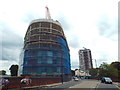
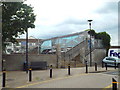
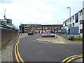
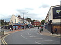
70 photos from this area
Area Information
Key information about the E13 0LS including its size, population, and administrative classification.
- Area Type
- Postcode
- Area Size
- 6817 m²
- Population
- 2189
- Population Density
- 24431 people/km²
House Prices in E13 0LS
48
Properties
£389,864
Average Sold Price
£50,000
Lowest Price
£693,000
Highest Price
Showing 48 properties
| Address | Type | Beds | Baths | Last Sale Price | Last Sale Date | |
|---|---|---|---|---|---|---|
| 57 Cecil Road, Plaistow, London, E13 0LS | Terraced | 3 | 1 | £520,000 | Apr 2023 | |
| 39 Cecil Road, Plaistow, London, E13 0LS | house | - | - | £290,000 | Oct 2022 | |
| 41 Cecil Road, Plaistow, London, E13 0LS | Terraced | 5 | 1 | £550,000 | Apr 2020 | |
| 77 Cecil Road, Plaistow, London, E13 0LS | Terraced | 5 | - | £693,000 | Oct 2018 | |
| 75 Cecil Road, Plaistow, London, E13 0LS | Terraced | 4 | - | £495,000 | Mar 2017 | |
| 67 Cecil Road, Plaistow, London, E13 0LS | Semi-detached | 4 | 2 | £550,000 | Dec 2015 | |
| 55 Cecil Road, Plaistow, London, E13 0LS | Terraced | 4 | 2 | £417,500 | Jun 2015 | |
| 65 Cecil Road, Plaistow, London, E13 0LS | Semi-detached | 4 | - | £395,000 | May 2014 | |
| 69 Cecil Road, Plaistow, London, E13 0LS | Semi-detached | 5 | 2 | £235,000 | May 2009 | |
| 45 Cecil Road, Plaistow, London, E13 0LS | Terraced | - | - | £50,000 | Sep 1998 |
Page 1 of 5
Energy Efficiency in E13 0LS
Amenities
Schools
| Rank | School | Type | Entry gender | Ages |
|---|
Explore more schools in this area
Go to Schools tabDemographics
Household Size
Family (3-5 people)
most common
Accommodation Type
Houses
most common
Tenure
44
majority
Ethnic Group
asian_total
most common
Religion
N/A
most common
Household Composition
N/A
most common
Age
47
median
Adults (30-64 years)
most common
Household Deprivation
N/A
with no deprivation
NS-SEC
24
in Lower managerial occupations
Explore more demographic insights in this area
Go to Demographics tabPlanning
Planning Constraints
- Flood RiskPremium
- Ramsar Wetland SitesPremium
- Area of Outstanding Natural BeautyPremium
- Protected Nature ReservePremium
- Protected WoodlandPremium