Area Overview for E13 0JG
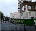
Photos of E13 0JG


Area Information
E13 0JG is a small, tightly knit residential postcode in east London with a population of 1,629. It sits within a cluster of homes that reflect the area’s character as a practical, accessible neighbourhood. Daily life here is shaped by proximity to transport hubs and a range of amenities, making it suitable for those prioritising connectivity over sprawling open spaces. The area’s demographics suggest a mature community, with a median age of 47 and a majority of residents aged 30–64. This suggests a stable, established population, many of whom may be long-term residents or professionals working in nearby business districts. The presence of multiple retail outlets, transport links, and proximity to London City Airport highlight its role as a commuter-friendly zone. While the area lacks natural landscapes, its urban infrastructure and accessibility to services like Eleanor Smith School and major rail lines offer a functional lifestyle. For buyers, E13 0JG represents a compact, well-serviced postcode with a clear focus on practicality and convenience.
- Area Type
- Postcode
- Area Size
- Not available
- Population
- 1629
- Population Density
- 14755 people/km²
The property market in E13 0JG is characterised by a high proportion of rental properties, with only 27% of homes owned by residents. This suggests that the area functions more as a rental market than an owner-occupied one, which may be due to its compact size and proximity to transport hubs. The predominant accommodation type is flats, which are common in urban areas with limited space. For buyers, this means that available properties are likely to be limited to flats, and competition may be higher in the owner-occupied segment. The small size of the postcode also implies that the immediate surroundings—such as nearby estates or developments—may hold more options for purchase. However, the low home ownership rate indicates that potential buyers should consider the broader local market beyond E13 0JG itself.
House Prices in E13 0JG
No properties found in this postcode.
Energy Efficiency in E13 0JG
E13 0JG’s residents have access to a range of amenities within walking or short transit distance. Retail options include Co-op Newham, Tesco New, and Tesco Green Gate, providing everyday shopping needs. The area’s proximity to multiple metro and rail stations, including Abbey Road DLR and Forest Gate, ensures easy access to broader London. While there are no named parks or leisure facilities listed, the presence of ferry piers and proximity to London City Airport suggest a focus on urban convenience rather than green spaces. The nearby Whipps Cross Bus Interchange adds to the area’s connectivity, facilitating travel to surrounding districts. This mix of retail, transport, and business hubs creates a practical lifestyle, ideal for those prioritising accessibility over expansive recreational areas.
Amenities
Schools
The nearest school to E13 0JG is Eleanor Smith School, a special school catering to students with specific educational needs. This suggests that the area may be particularly suited to families requiring specialist provisions for children. While no other schools are listed in the data, the presence of a special school indicates that the community is likely to include residents with children who benefit from tailored support. For families seeking mainstream education, the lack of listed primary or secondary schools implies that nearby options may require a short commute. However, the proximity to major transport links, such as DLR stations and rail services, could mitigate travel time to schools in adjacent areas.
| Rank | School | Type | Entry gender | Ages |
|---|
Explore more schools in this area
Go to Schools tabDemographics
The community in E13 0JG is predominantly composed of adults aged 30–64, with a median age of 47. This indicates a mature population, likely with established careers and family commitments. Home ownership is relatively low at 27%, suggesting that a significant portion of the housing stock is rented, which may reflect the area’s role as a rental market. The primary accommodation type is flats, which aligns with the density of the postcode and the presence of multi-unit buildings. The predominant ethnic group is Asian, though specific subgroups are not detailed. This diversity contributes to the area’s cultural profile, though it is not explicitly quantified. The absence of data on deprivation levels means that quality-of-life factors such as access to services and employment opportunities must be inferred from the available amenities and transport links.
Household Size
Accommodation Type
Tenure
Ethnic Group
Religion
Household Composition
Age
Household Deprivation
NS-SEC
Explore more demographic insights in this area
Go to Demographics tabPlanning
Planning Constraints
- Flood RiskPremium
- Ramsar Wetland SitesPremium
- Area of Outstanding Natural BeautyPremium
- Protected Nature ReservePremium
- Protected WoodlandPremium