Area Overview for E13 0JA
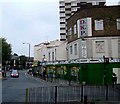
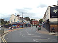
Photos of E13 0JA


Area Information
E13 0JA is a small, tightly defined postcode area in east London, home to 1,629 residents. Its compact size means it is a focused residential cluster, likely centred on a specific development or housing scheme. Daily life here is shaped by proximity to transport hubs and retail centres, with residents enjoying easy access to multiple metro, rail, and ferry routes. The area’s character is defined by its practicality: it is not a sprawling suburb but a concentrated community where amenities are within walking or short transit distance. With a median age of 47 and a population skewed toward adults aged 30–64, the area likely hosts a mix of long-term residents and professionals working in nearby sectors. The presence of flats as the primary accommodation type suggests a rental-focused market, though 27% of homes are owner-occupied. This blend of housing types and demographics creates a lived-in, functional environment suited to those prioritising convenience over sprawling green spaces.
- Area Type
- Postcode
- Area Size
- Not available
- Population
- 1629
- Population Density
- 14755 people/km²
E13 0JA’s property market is heavily rental-focused, with only 27% of homes owned by residents. The prevalence of flats suggests a housing stock designed for high-density living, likely in older developments or purpose-built blocks. This type of accommodation is typical in areas with limited space for larger homes, and it aligns with the area’s compact nature. For buyers, this means the market is not dominated by owner-occupied properties but rather by landlords and private renters. The small size of the area means housing stock is limited, and competition for available flats may be keen. Prospective buyers should consider the rental market’s dynamics, as property values may be influenced by demand from tenants rather than long-term ownership. The lack of detached or semi-detached homes further reinforces that this is not a traditional suburb but a functional, urban residential cluster.
House Prices in E13 0JA
No properties found in this postcode.
Energy Efficiency in E13 0JA
E13 0JA’s residents have access to a range of amenities within easy reach. Retail options include Co-op Newham, Tesco New, and Tesco Green Gate, providing everyday shopping needs. For transport, the area is served by multiple metro, rail, and ferry routes, including Upton Park Station and Royal Wharf Pier. The presence of Whipps Cross Bus Interchange adds further connectivity. While the area lacks major parks or leisure facilities, its proximity to London City Airport and the surrounding transport network supports a dynamic lifestyle. Residents can easily access cultural and commercial hubs in east London, from the financial district to leisure destinations. The mix of retail, transport, and travel options means daily life in E13 0JA is efficient, with minimal need for long commutes or detours.
Amenities
Schools
The nearest school to E13 0JA is Eleanor Smith School, a special school. No further details about its Ofsted rating or curriculum are available in the data. This suggests that families requiring specialist education for children with additional needs may find this school a key resource. However, the absence of mainstream primary or secondary schools in the immediate vicinity could mean that families with children not requiring special education may need to look further afield. The single school listed indicates a limited local educational infrastructure, which may affect the area’s appeal to families prioritising a range of school options. Parents should consider the availability of other schools in nearby postcodes, as E13 0JA itself offers only one dedicated educational institution.
| Rank | School | Type | Entry gender | Ages |
|---|
Explore more schools in this area
Go to Schools tabDemographics
The population of E13 0JA is predominantly adults aged 30–64, with a median age of 47. This suggests a community of established professionals and families, rather than a younger or elderly demographic. Home ownership is relatively low at 27%, indicating that most residents rent their homes. The area is characterised by flats, which dominate the accommodation type. This reflects a housing stock likely developed in the mid-20th century, with a focus on high-density living. The predominant ethnic group is Asian, though no further breakdown is provided. This diversity may influence local culture and community dynamics. With 1,629 residents, the area is small enough to foster a close-knit community but large enough to support essential services. The age profile implies a stable population, with fewer young families or retirees compared to other parts of London.
Household Size
Accommodation Type
Tenure
Ethnic Group
Religion
Household Composition
Age
Household Deprivation
NS-SEC
Explore more demographic insights in this area
Go to Demographics tabPlanning
Planning Constraints
- Flood RiskPremium
- Ramsar Wetland SitesPremium
- Area of Outstanding Natural BeautyPremium
- Protected Nature ReservePremium
- Protected WoodlandPremium