Area Overview for E13 0HP
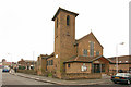
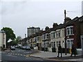
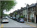
Photos of E13 0HP


Area Information
E13 0HP is a small, compact postcode area in east London, home to 1,868 residents. Its residential cluster format means it is not a sprawling suburb but a focused community with a distinct character. The area’s proximity to major transport hubs and amenities makes it appealing for commuters and those seeking convenience. Daily life here is shaped by its connectivity to rail, metro, and ferry services, which link residents to the city’s broader network. The population is relatively small, fostering a tight-knit environment, though the area’s size means it is more of a micro-destination than a standalone town. Living in E13 0HP involves navigating a mix of urban infrastructure and suburban tranquillity, with access to shops, schools, and transport within walking or short transit distance. The area’s appeal lies in its balance of practicality and accessibility, making it a viable option for those prioritising ease of movement over sprawling green spaces.
- Area Type
- Postcode
- Area Size
- Not available
- Population
- 1868
- Population Density
- 8010 people/km²
The property market in E13 0HP is dominated by flats, with 25% of homes owner-occupied. This indicates a rental-heavy market, where private landlords and housing associations likely hold significant shares. The concentration of flats suggests limited availability of larger, detached properties, which may be more suited to families or those seeking more space. For buyers, this means the area is not ideal for those prioritising homeownership, but it offers a range of smaller, manageable units. The small population and compact size of the postcode mean property values are likely influenced more by proximity to transport and amenities than by the size of the housing stock. Buyers should consider whether the flat-based market aligns with their long-term goals, particularly if they require a larger property or a garden.
House Prices in E13 0HP
No properties found in this postcode.
Energy Efficiency in E13 0HP
Living in E13 0HP offers access to a range of amenities within walking or short transit distance. Retail options include Iceland 359, Co-op Newham, and Iceland 480–482, providing everyday shopping needs. The area’s transport links—such as Star Lane Station, Abbey Road DLR Station, and Maryland Station—connect residents to leisure, employment, and cultural hubs across London. Ferry services to Royal Wharf Pier and East India Pier offer alternative routes for commuting or recreation. The proximity to London City Airport and Whipps Cross Bus Interchange further enhances connectivity. While the area lacks large parks or leisure facilities, its density of transport and retail options supports a practical, urban lifestyle. The mix of shops, stations, and ferry access ensures residents can meet daily needs without long journeys, contributing to a convenient, if compact, living experience.
Amenities
Schools
The nearest school to E13 0HP is Grange Primary School, which has an Ofsted rating of ‘good’. This is the only school listed in the data, meaning families with children will need to look beyond the immediate area for secondary education. The presence of a well-rated primary school is a positive for the community, though the lack of secondary schools nearby may be a consideration for those planning for long-term family needs. The school’s rating suggests a standard of education that meets regulatory benchmarks, but parents should investigate further to understand the full range of educational options available. For those prioritising proximity to schools, the area’s small size means the primary school is within easy reach, but secondary options will require commuting.
| Rank | School | Type | Entry gender | Ages |
|---|
Explore more schools in this area
Go to Schools tabDemographics
The population of E13 0HP is predominantly adults aged 30–64, with a median age of 47. This suggests a mature, established community, likely with a mix of long-term residents and professionals. Only 25% of households are owner-occupied, indicating that the area is more rental-focused than owner-occupied. Flats are the primary accommodation type, reflecting a high density of apartments rather than detached homes. The predominant ethnic group is White, though no specific diversity statistics are provided. The lower home ownership rate may correlate with a transient population or a focus on rental properties. For buyers, this means the area’s housing stock is largely composed of flats, which may appeal to those seeking urban living with minimal maintenance. The age profile suggests a stable, low-turnover community, which can be a factor in property value trends.
Household Size
Accommodation Type
Tenure
Ethnic Group
Religion
Household Composition
Age
Household Deprivation
NS-SEC
Explore more demographic insights in this area
Go to Demographics tabPlanning
Planning Constraints
- Flood RiskPremium
- Ramsar Wetland SitesPremium
- Area of Outstanding Natural BeautyPremium
- Protected Nature ReservePremium
- Protected WoodlandPremium