Area Overview for E13 0DB
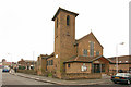
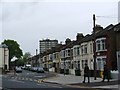
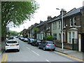
Photos of E13 0DB


Area Information
Living in E13 0DB means being part of a small, tightly knit residential cluster in east London. With a population of 1830, this postcode area is compact but functional, serving as a base for commuters and families alike. The community is predominantly composed of adults aged 30–64, with a median age of 47, suggesting a mature demographic that may prioritise stability and established living. The area’s character is shaped by its proximity to transport hubs, including DLR stations, rail lines, and ferry piers, which make it a practical choice for those needing regular access to central London. While the housing stock is primarily composed of houses, the relatively low home ownership rate of 38% indicates a mix of rental and owner-occupied properties. E13 0DB is not a sprawling suburb but a focused postcode, meaning its immediate surroundings offer a blend of local amenities and broader urban connectivity.
- Area Type
- Postcode
- Area Size
- Not available
- Population
- 1830
- Population Density
- 15776 people/km²
The property market in E13 0DB is defined by its low home ownership rate of 38%, which suggests that rental properties dominate the housing stock. The area is primarily composed of houses, which may appeal to buyers seeking more space than the typical flat. However, the small population and limited number of homes mean the market is not expansive, and buyers may need to consider nearby areas for more options. The predominance of houses could indicate a focus on family homes, though the low ownership rate suggests a transient element. For those interested in purchasing, the limited number of properties may mean competition is manageable, but the area’s size restricts the availability of diverse housing types.
House Prices in E13 0DB
No properties found in this postcode.
Energy Efficiency in E13 0DB
E13 0DB’s residents have access to a range of amenities within walking or short transit distance. Retail options include Co-op Newham and Iceland stores, providing essential shopping. The area’s transport network is a key feature, with DLR stations like Plaistow and Star Lane, rail links to West Ham and Custom House, and ferry piers at East India and North Greenwich. London City Airport is also nearby, adding to the area’s appeal for those needing frequent travel. While the data does not specify parks or leisure facilities, the proximity to transport hubs and retail suggests a lifestyle focused on convenience and accessibility. The mix of local shops and transport options supports a practical, urban-oriented daily life.
Amenities
Schools
| Rank | School | Type | Entry gender | Ages |
|---|
Explore more schools in this area
Go to Schools tabDemographics
E13 0DB’s population of 1830 is predominantly adults aged 30–64, with a median age of 47. This suggests a community of established professionals and families, rather than students or retirees. Home ownership here is relatively low at 38%, indicating that a significant proportion of residents rent their homes. The area is characterised by houses rather than flats, which may appeal to those seeking more space or garden access. The predominant ethnic group is Asian, reflecting a culturally distinct community. While specific data on deprivation is not provided, the demographic profile implies a mix of household types, likely including families and couples. The age range and ownership figures suggest a balance between long-term residents and those seeking affordable housing in a convenient location.
Household Size
Accommodation Type
Tenure
Ethnic Group
Religion
Household Composition
Age
Household Deprivation
NS-SEC
Explore more demographic insights in this area
Go to Demographics tabPlanning
Planning Constraints
- Flood RiskPremium
- Ramsar Wetland SitesPremium
- Area of Outstanding Natural BeautyPremium
- Protected Nature ReservePremium
- Protected WoodlandPremium